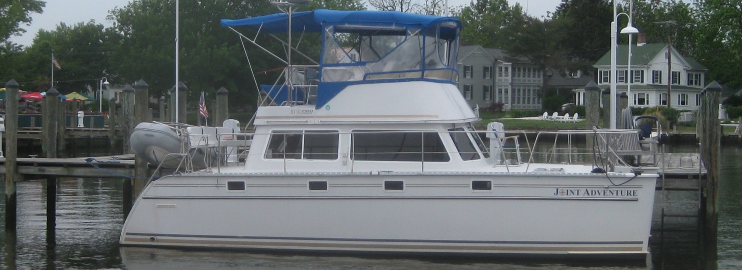
Post #21 – THE POOL – Day 90 – August 1, 2014. On board: Jim Small & Chrissie Bell, Pat & Paul Coates, Jim & Trish Koningisor
Every once in a while, you discover a place that is truly memorable. A woman who lives locally first told Trish about an anchorage called The Pool at the end of a 10-mile long unmarked channel. I checked it out on the charts – no way were we going in there. Less than 4 feet of water over rocks through a narrow entrance, then unmarked rocks further down the channel. Later that day, while doing laundry (this time I washed the clothes only once), I was looking through the charts at the Laundromat, planning the next day’s run while waiting for the clothes to dry. A man looked over my shoulder and started to tell me about The Pool. I pulled out the chart and told him “no way – look at the shallow water at the entrance”. He told me not to believe the chart (!?!) – the water was much deeper than the chart shows. Another guy came over and chimed in – you have to go, he said – the chart is wrong. So on Sunday morning, off we went. It turned out to be one of the most memorable places we’ve been so far. It is a small bay at the end of a beautiful 10-mile long channel with rock cliffs and forested hillsides along both sides – it has the feel of a fiord as you move up the channel. Here are some pictures:

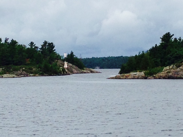
The entrance to the 10-mile long channel is up ahead

Rock cliffs and forested hillsides lined the 10-mile long channel leading to The Pool
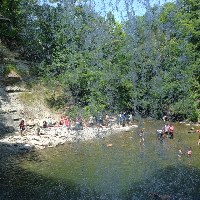
After a 90 degree bend, we entered The Pool, a small bay protected on all four sides. After our second attempt at anchoring was successful, we launched the dinghy and went ashore at a small trailhead which leads to Topaz Lake – with 150′ of depth, the color of the water is topaz, hence the name. We spent the afternoon swimming in the lake, hiking to the top of the mountain, and marveling at the views. The pictures describe it better than I can:
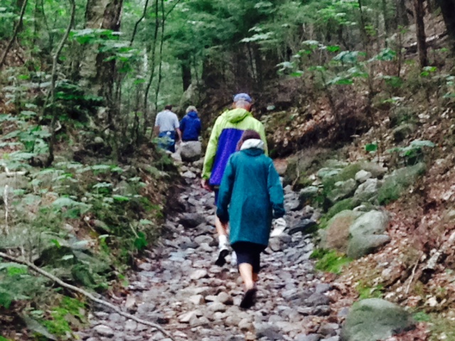
Hiking up a dry stream-bed up to Topaz Lake
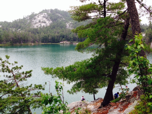
After a 20 minute hike, Topaz Lake comes into view –
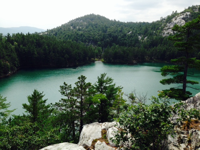
Another view of Topaz Lake – water 150 feet deep trapped by the surrounding ridges, which are solid rock

“No, don’t jump! OK, you can have the last Heinekin!”
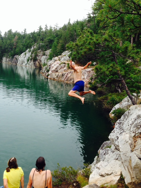
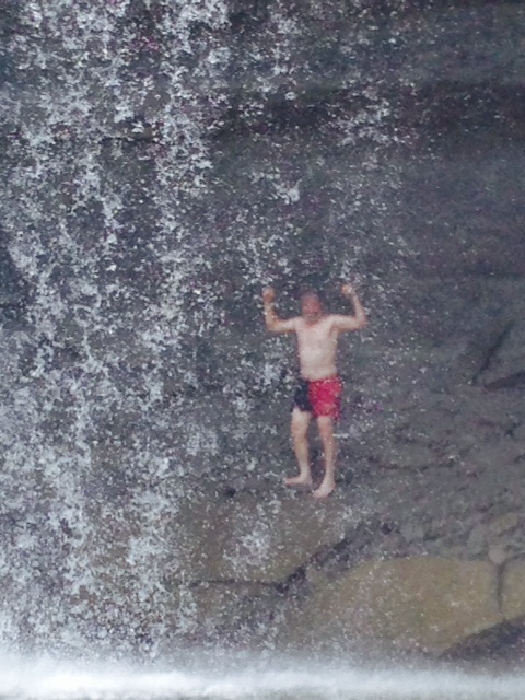
Paul is practicing for the 2016 US Olympic Diving Team – he calls this the Butterfly Dive
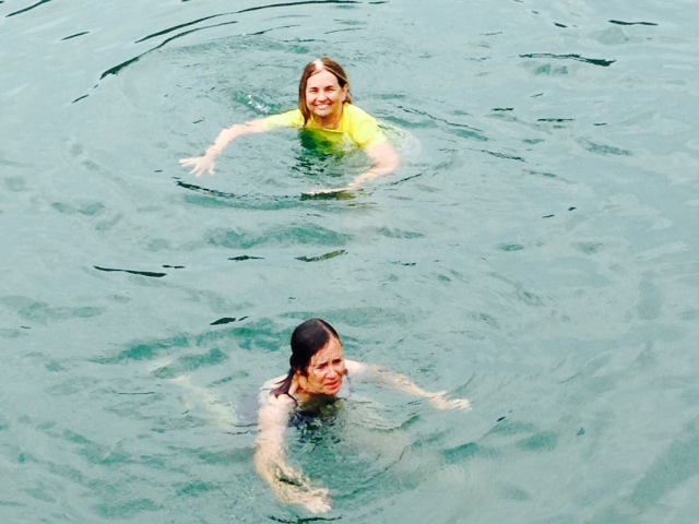
After a more graceful entrance, Trish & Pat enjoy the refreshing water

Jim & Chrissie on the cliff overlooking the lake, watching Trish & Pat swimming below
After our swim, we hiked up to the top of the ridge which overlooked both Topaz Lake and The Pool, where the Joint Adventure and other boats were anchored. We munched on wild blueberries, which grew along the rocks as we climbed. The views were breathtaking:
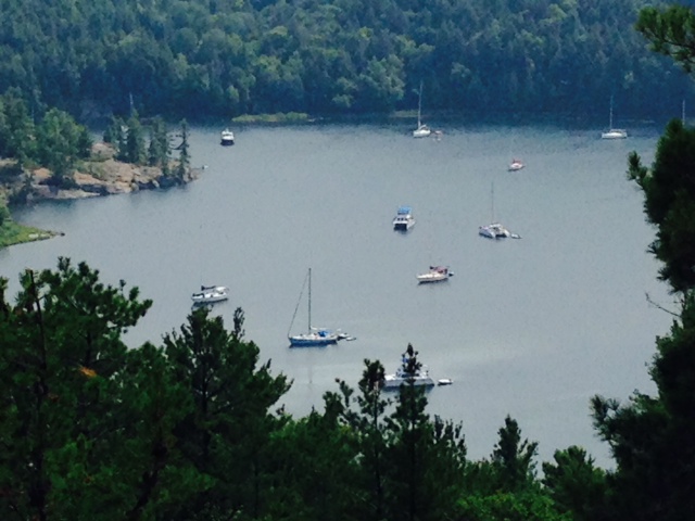
The Pool, as seen from a rock outcropping on the way up the ridge. The Joint Adventure can be seen anchored in the center of The Pool

Another view of The Pool from the ridge

The Pool from the top of the ridge, which is solid bedrock as seen in the foreground

We helped ourselves to the wild blueberries that grew everywhere among the rocks

Resting on the rocks on the way down –

A “selfie” from the top of the ridge – left to right, Paul, Chrissie, Trish, Jim, Jim K, and Pat. You can see The Pool in the background
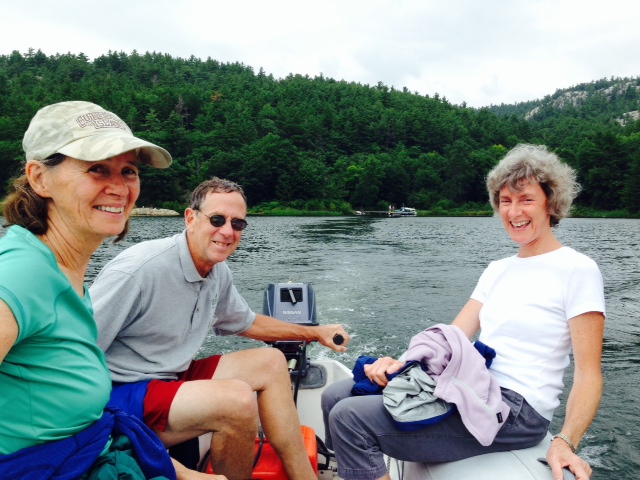
Motoring back to the Joint Adventure in the dinghy after the hike to Topaz Lake and the ridge

Our friends Tom & Tim were anchored in The Pool with us as well – they dinghied over to us (can dinghy be a verb?) and joined us for horderves in the evening
The evening weather turned perfect, and we cooked dinner on board and ate on the bridge. As we retired for the evening, there was not a breath of wind, so I relaxed with the expectation of a worry-free night at anchor. However, a noise woke me up at about 4:00 AM – I went outside to investigate, only to discover that the wind was howling. I checked the anchor and anchor line – everything was in order and we had not moved, but I knew I would not get back to sleep. Another boat nearby did drag anchor, but was not a threat to us. So I sat in the dark until the sun started to rise. However, later that morning when we went to leave, the anchor was set in the mud and weeds so solidly that we could barely pull it free, even with the trip line we had put on. I could have gotten a full night’s sleep!
On Monday, the wind was still strong, so we decided to stop at Little Current rather than go further as we had planned. On Tuesday morning, we headed to a small town on the North shore of Manitoulin Island called Kagawong. The name came from the native Ojibwe that inhabited the region before Europeans arrived and means “where mists rise from falling water”, an obvious reference to Bridal Veil Falls described below. Like most of the towns and villages in the North Channel, Kagawong began with the construction of a sawmill in the 1830’s. It grew and thrived as the lumber business grew. Trees were harvested in the fall and winter, then floated through the North Channel to the sawmills and pulp mills. In the first half of the 1900’s, the lumber business declined as the nearby forests were clear-cut and trees had to be brought from further and further away, which eventually became uneconomic. Eventually, all the saw mills and pulp mills closed, although historic remnants of them still exist and can be visited. Kagawong today has a small harbor and is off the beaten path from the route taken by most cruisers. However, it far exceeded our expectations, with extensive hiking trails, Bridal Falls, and a few unique shops. Here are pictures from Kagawong:
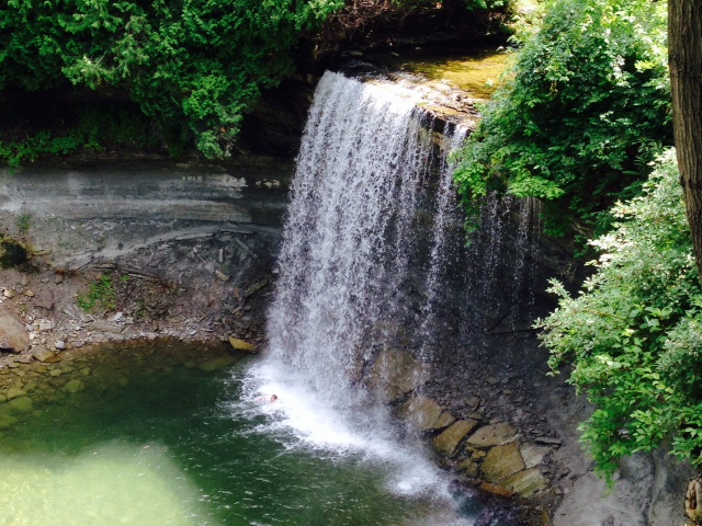
Bridal Falls, with a pool to swim in at the base. The rock is carved away behind the falls as well, so you can actually walk behind the falls
Bridal Falls – the water was cold, but the pool at the bottom was a refreshing swim
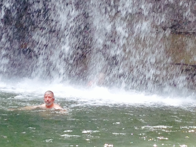
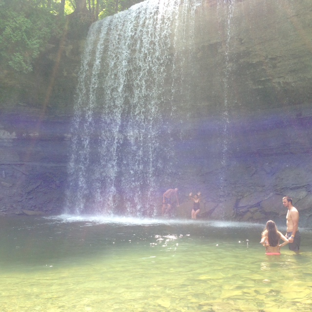
Swimming below the falls – you can actually get directly under the falling water – a weird sensation!

Pat and Trish swimming at the base of the falls
There is a path that goes directly behind the falls – there is a surprising amount of wind behind the falls, generated by the falling water
This picture is taken from behind Bridal Falls

Chrissie, Jim, and Trish enjoying the falls on the rocks adjacent to the pool
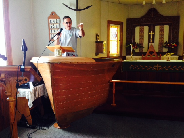
Jim telling us to “REPENT!” The pulpit in the Anglican Church in Kagawong is the bow of a boat

One of the shops features a people-size checkers game and chess game
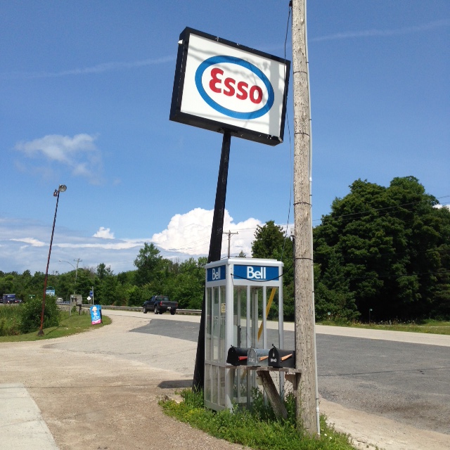
Time is a bit behind on Manitoulin Island – when is the last time you saw an Esso sign OR and phone booth?

A storm built in the late afternoon – the wind kicked up, and whitecaps started rolling in. We doubled all the dock lines, took down the aft bimini, and secured everything on deck. Of course, all that preparation caused the storm to bypass us, and soon the wind diminished
Speaking of weather, we have had temperatures that are cooler then normal for most of our time in Canada, but very little rain. In fact, we haven’t had a weather day where we didn’t run due to rain since we left the St. Lawrence River in early June – any weather days we’ve taken have been due to wind rather than rain, and those have averaged only about one day per week – overall, no complaints! Temperatures in the morning on cold days can be in the 50’s, but typically warm up by the afternoon. Temperatures in the afternoon are typically in the low to mid 70’s. We did have a string of very hot days on the Trent Severn, but have not had much very hot weather once we have gotten further north.
Everyone we have run into in this part of Canada are avid Toronto Maple Leaf fans. They hate the Montreal Canadiens, and would rather see the Bruins or anyone else win than the Canadiens. However, it is not easy being a Maple Leafs fan – one man told us “I was in diapers the last time the Maple Leafs won the Stanley Cup, and I’ll be in diapers before they win again.”
One last image from Kagawong – in the morning, there were literally hundreds of thousands of dragonfly-like bugs called shagflies everywhere – on the boat surface, on the road, on the walls of buildings – everywhere! There must have been at least a thousand on the Joint Adventure alone! It took a half hour to hose them all off before we could get going. We have since learned that they live underwater as larvae for up to 7 years, and then hatch sporadically in huge groups and live for just 24 hours. Everyone said they had never seen a hatching like the one we happened to experience that morning in Kagawong. The next day in Gore Bay, just a few miles away as the crow flies on the same island – nothing.
Here is a picture from when we awoke:

Dragonfly-like bugs covering the Joint Adventure in the morning

The sailboat a couple slips away from us got even more covered than we did –
From Kagawong, we went to Gore Bay, also on Manitoulin Island. We rode our bikes to the Janet Point lighthouse, where we took a tour and learned some of the history and folklore. It was built in 1879, and the first lighthouse keeper experienced extreme tragedy. At that time, all food and supplies had to be brought to the island from the mainland 20 miles away. There we no bridges, so the only route in the winter was over the ice. The light keeper’s wife and 16 year old son left one day on a sleigh pulled by two oxen to get supplies. A fierce storm arose, and they became trapped somewhere on the ice. The light keeper didn’t learn that his wife never arrived for about a week. At that time, he set out with another pair of oxen to search for them. He also brought two 11 year old girls with him who needed to get to the mainland. He got caught in a fierce storm somewhere on the ice as well. When a third rescue team finally found both parties, the wife had died of exposure, but the son was alive – he lost both feet to frostbite, but survived and lived an active life, having had both legs fitted with wooden pegs. His granddaughter actually visited Janet Point Light a year or two ago. The light keeper also survived, but one on the 11 year old girls died of exposure. Life was tough back then, especially in the winter.
Later, from 1910 to 1924, an ice highway was marked off each winter to facilitate travel from Gore Bay to the mainland. Janet Point Light guided travelers on the ice highway during the winter, in addition to guiding vessels in the North Channel in the summer.
Here is a picture of Janet Point Light:
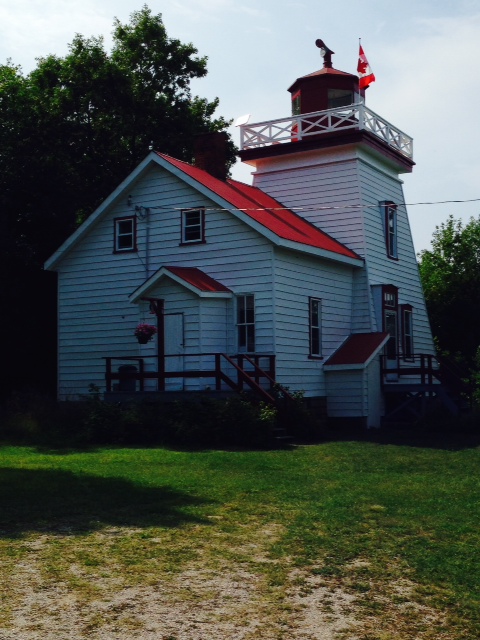
Janet Point Light – now automated, it is occupied in the summer by the fourth generation of the Foster family, who gives tours of the lighthouse
One other note of interest regarding lighthouse keepers – Jim Small’s grandfather was the lighthouse keeper at Boston Light for many years, and Jim’s father grew up living on the island until he reached high school age. He would row to school each day in Hull, regardless of the weather, then row home at the end of the day. When he reached high school age, he stayed on the mainland and attended school. If you see Jim around, ask him about some stories from his father – truly fascinating.
We left Gore Bay on a somewhat cold, grey Thursday for the 50 mile run to Blind River. The scenery was spectacular as we went west along a string of islands, but we got bounced around a bit until we got into the shelter of the islands. A few pictures from our run:
About to enter a narrow passage between two islands. Notice the markers on the left bank – they’re called range finders. One is mounted low, and the other is mounted a fair distance back and higher than the first. Coming into a channel, you line them up vertically as you proceed into the channel – when they are aligned, you will be in the centerline of the channel

Paul and Jim bundled up – OK, it was cold, but not that cold…

The cold didn’t seem to bother Chrissie as she expertly piloted the boat
Blind River is a small town on the north shore of the North Channel (on the mainland) that has seen better days – the economy is depressed and main street in the little town is struggling with a number of vacant storefronts. However, we found an extensive system of trails through the woods suitable for biking, and went on a long bike ride. We also noticed a fishing boat entering the harbor, tracked it down, and bought filets of fresh whitefish, caught just hours earlier. A great meal aboard that night!
Blind River also marks a significant milestone on our journey – it is the northernmost point that we will reach. From here on, we start to work our way south – gradually for awhile, as we still need to go further west, until we turn abruptly south after transiting the Mackinaw Straight. More on that later.
Today (Friday), we reached another significant milestone – after a 44 mile run, we re-entered the United States, clearing customs at Drummond Island, Michigan. A few thoughts about Canada after spending the past month and a half in Canadian waters: The people are extremely friendly and hospitable, proactively going out of their way to help. The children we encountered were well behaved and extremely polite. The cities, towns, streets, parks, and waterways are extraordinarily clean with little or no visible trash or debris. The infrastructure is remarkable – the parks, waterways, locks, etc. are extraordinary and well maintained. Canada is a very pleasant place to vacation – I would come back in a heartbeat.
Tomorrow we head to DeTour, Michigan where (sadly) Jim & Chrissie will leave us but (happily) Jerry & Sheila Solomon will join us for the next week as we head towards Lake Michigan.

Jim, is DeTour the northern most point of your trip?
How many bandaids have you gone through?
Jim and Trish,
The pictures look AWESOME! And the story is great, too. Jim and Trish, I am trying to picture the conversation between you when Jim tells Trish, “I know the charts make the route look unnavigable (and unsafe), but these two dudes told me to ignore the charts and that is what we are going to do.” EXCELLENT… You can’t make this stuff up. And look at those pictures. Amazing!
I am glad that you are having such a great adventure. Emily, Patrick and I just arrived in Salt Lake City on our way to Jackson Hole, Wyoming.
Please give my best to all,
Michael Denning
Trish and Jim, I’ve been wondering how your great adventure was going! It suddenly occurred to me to google Great Loop Koningisor… And voila! I read everything posted so far tonite. Truly sounds like a wonderful time. Now I’ve added this blog to my RSS feed so I will be able to continue along with your trip! Do you get any closer to Ohio than Chicago?? Best wishes for the remainder of the trip.
Beautiful country!!! Thank you for sharing. Also those dragonlike critters that were covering the boats (and probably everything else) are also present here along the Mississippi and Illinois Rivers. Down here they are called Mayflys and they appear overnight and are all gone (mainly deceased) by the next day. We found the best way was to wash them off the boat with the hose. Good news is they are all gone down here so you will not run into them when you get this far south.
Thanks again for the wonderful documentation and photos
Sincerely,
Bob Wadlow