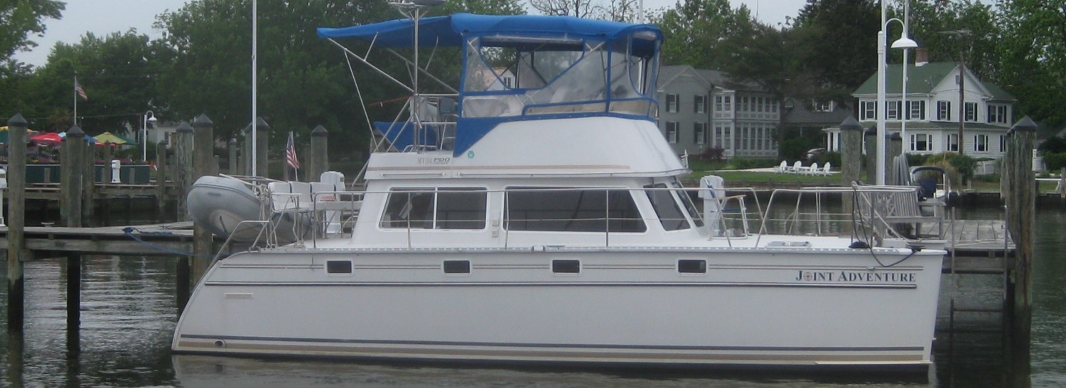
Post #23 – UNPLANNED GEMS – August 12, 2014 – Day 101 – On board: Thru Saturday, August 9: Pat & Paul Coates, Jerry & Sheila Solomon, Jim & Trish Koningisor. August 9 – August 15: Wendy Barnes & Knif; Jim & Trish Koningisor
Charlevoix is the crown jewel of cruising northern Lake Michigan – it was recently named in a survey as the second best cruising harbor in the world (it is really, really nice, but that seems a bit of a stretch to me…). The harbor and village are centered around Round Lake, a pond-sized body of water fronted by a park, docks, and homes at the waters edge. On the other side of Round Lake is Lake Charlevoix, a 26 mile long lake that is its own cruising ground. The village has a beautiful Main Street with boutiques, galleries, shops, and restaurants. The park along the vibrant waterfront is meticulously maintained with fountains, sculptured terraces, flowers, and beautiful landscaping.
Here are some pictures from our stay in Charlevoix:

This iconic and well-known lighthouse on the end of the jetty welcomes visitors entering the harbor

Charlevoix Harbor (Round Lake) as seen from the waterfront park

Homes right down to the waters edge line a portion of Charlevoix Harbor

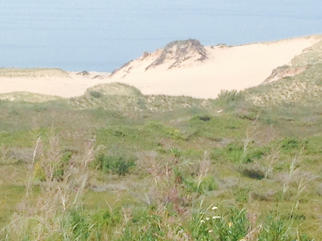
The northeastern shore of Michigan has massive sand dunes – some rival the sand dunes of the Cape Cod National Seashore. We biked to a trailhead that leads into the sand dunes a few miles from the harbor

The dunes a few miles from Charlevoix Harbor

We bought fresh fish from the fish market in Charlevoix and ate dinner on the bridge, listening to the concert in the park right next to the docks. Paul cooking on the grill attached to the rail at the bow of the boat
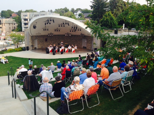
Although I’d like to take credit for great planning, the concerts we’ve encountered have been by dumb luck. It was a Thursday night, but Charlevoix had an amazing all-brass band playing in the park adjacent to us.

A picture of the concert taken from the bridge of the Joint Adventure
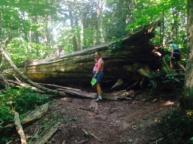
While biking to the trailhead in Charlevoix, we came upon an overnight kids’ camp. It reminded me of the time we sent our oldest daughter Jessie to her first overnight camp. She was about 6 and 7, stubbornly independent, and insisted on packing her own suitcase – which we forgot to check before she left. When we picked her up on the last day, she came bounding out of the cabin wearing a T-shirt that our friend Louise had given me as a gag gift for my birthday – a yellow T-shirt, it had in huge purple letters across the front: PARTY TILL YOU PUKE. For some reason, Jessie wasn’t invited to any playgroups from that camp…
The need to make sure we have a safe place to stay each night and our planned crew changes each Saturday require us to do some basic planning each week as we move forward. However, we try to build in enough flexibility to take advantage of unplanned discoveries along the way – The Pool in the North Channel was one such unplanned gem. We experienced two more over the past several days – one of them thanks to Glenn & Linda, friends of Jerry who live in Charlevoix and visited us on the boat in the evening in Charlevoix. Glenn gave us local tips about cruising south on Lake Michigan, including a recommended stop on South Manitou Island, home to a portion of Sleeping Bear Dunes National Lakeshore. Although it added 25 miles to our trip on Friday, the weather was sunny, warm, and calm, so we decided to go. The island is part of a chain that extends north to Mackinaw Straight, and consists of tilted layers of limestone buried under a blanket of glacial debris. The islands poke above the surface of Lake Michigan, and the glacier left piles of fine, ground-up rock – therefore, winds blowing on the high bluffs trapped sand, forming enormous dunes. In addition to the dunes on the island, there is an old-growth cedar forest, a shipwreck, and a tall lighthouse that you can tour on the island. Here are some pictures:
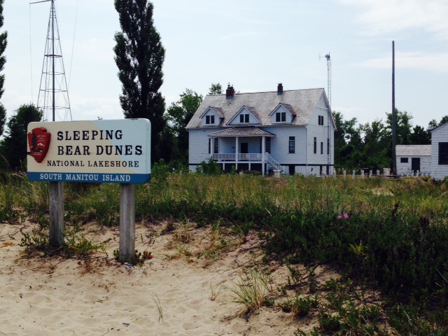
Visitors to the island, which is served by a ferry from Leland as well as access by private boat, are greeted by this sign and ranger station

The lighthouse on South Manitou Island near the ferry dock
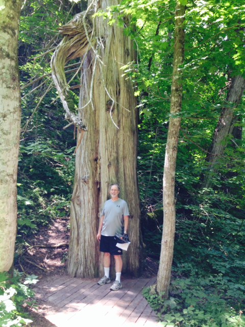
An old-growth cedar tree, part of a beautiful hike through the forest on the island
A fallen cedar tree along the hiking trail
The trail leads from the old-growth cedar forest to miles of sand dunes lining the west shore of the island.
These dunes were truly amazing –
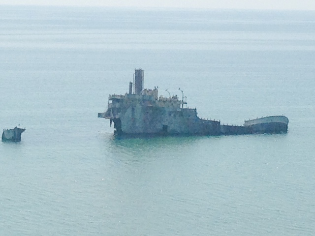
Gambling to make one last trip before winter, the Francisco Morazán left Chicago bound for Holland via the St. Lawrence Seaway on November 27, 1960 carrying nearly 1,000 tons of general cargo. Blinded by fog and heavy snow in 40 MPH winds, she went aground 300 feet off South Manitou Island. All hands survived. However, the owners of the ship could never be found, so she still rests there today.

On the boat on the way to Leland after an afternoon of hiking, Sheila needed to re-charge…
We arrived in Leland Harbor around 5:30 Friday evening. Sadly, Jerry & Sheila leave us from here, and also sadly, Pat leaves after spending most of the summer on the boat. Paul leaves for a week but will return next Sunday. Happily, Wendy Barnes & Knif join us in Leland through next Friday. Here is a group photo marking the changing of the crew: –
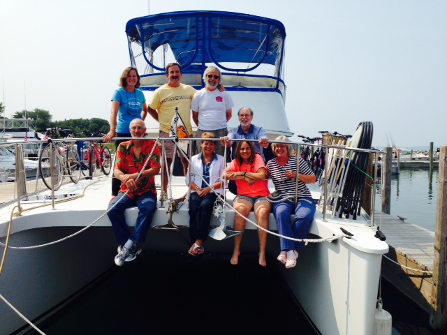
A “groupie” at our changing of the crew – back row, left to right: Pat, Knif, Jim K, Jerry (Sol); front row, left to right: Paul, Wendy, Trish, Sheila
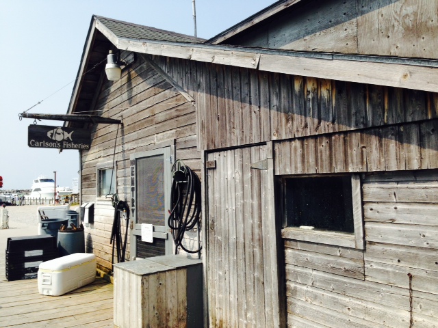
Leland is a small, historic, well-kept village located where the LeLand River empties into Lake Michigan. The Ottawa Indians found it to be the perfect place to settle, and the village became the oldest and largest Indian village of its kind on the Leelanau Peninsula. Millennia later, European settlers found it just as enticing and built Leland on the site of the old Indian village. Leland was settled by fisherman 150 years ago, and the village has stubbornly held onto its fishing legacy while nearly all commercial fisheries on the Great Lakes have disappeared. The heart of historic Leland are the fishing shanties along the river adjacent to the harbor, called Fishtown. The shanties were built around the turn of the century, where a handful of fisherman set out from the mouth of the Leland River below a dam and abandoned sawmill – a legacy from the days when the lumber industry drove the local economy. As fishing declined later in the 20th century, many of the shanties were abandoned and fell into disrepair. In the 1970’s, the US government banned gill nets on the Great Lakes. A final death sentence, nearly all commercial fisheries on the Great Lakes collapsed. However, a few fishing families in Leland adopted new methods and held on. The shanties were saved by a local fishing family (now into its fifth generation of fishermen) who bought many of them and found new uses for those no longer used to support fishing. Today the shanties provide an eclectic collection of uses from fish markets to specialty shops. Fishtown is a working harbor and active market – it is a rare working and historic example of a once-thriving way of life on the Great Lakes. Here are some pictures:
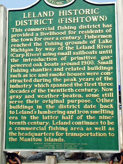
A historical market with a brief overview of Leland history
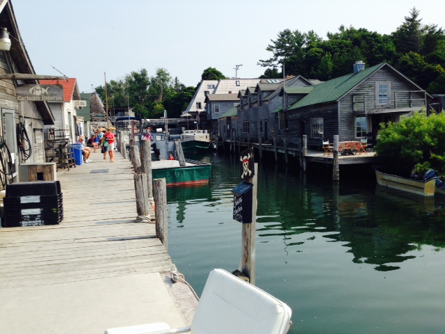
The shanties of Fishtown, looking up the Leland River

Wendy & Nif pausing in front of the fish market in Fishtown
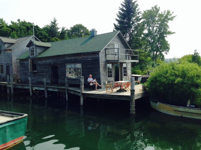
A Fishtown shanty –
The shanties are weathered but serve their purpose well

Fishtown looking down-river, towards Lake Michigan. The harbor in Leland outside of the narrow Leland River was created as a harbor-of-refuge – the rock breakwater can be seen in the background
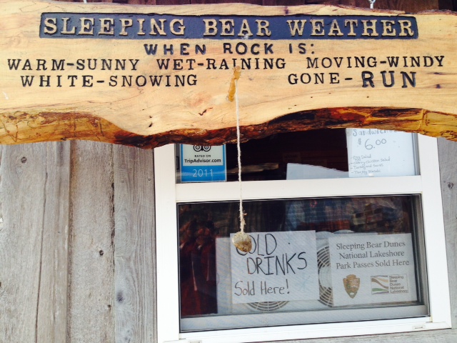
A sign in Fishtown to assist tourists in determining the weather at Sleeping Bear Park
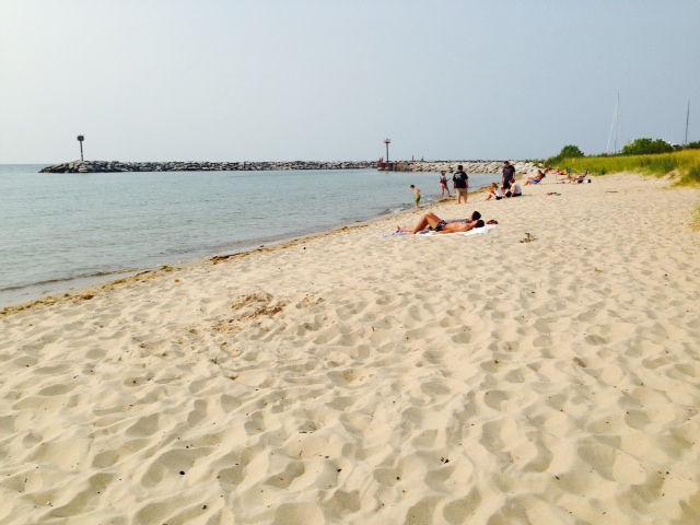
The beach at LeLand – all of the villages and towns along the northeastern shore of Lake Michigan have fabulous beaches due to the abundance of beautiful, fine-grained sand built up since the glacier retreated. The weather has been sunny and warm for the past 10 days, so we go for a swim most afternoons. However, the water is quite – shall we say “refreshing” – colder than usual due to the very cold winter, the late break-up of the ice, and the unseasonably cool first half of the summer
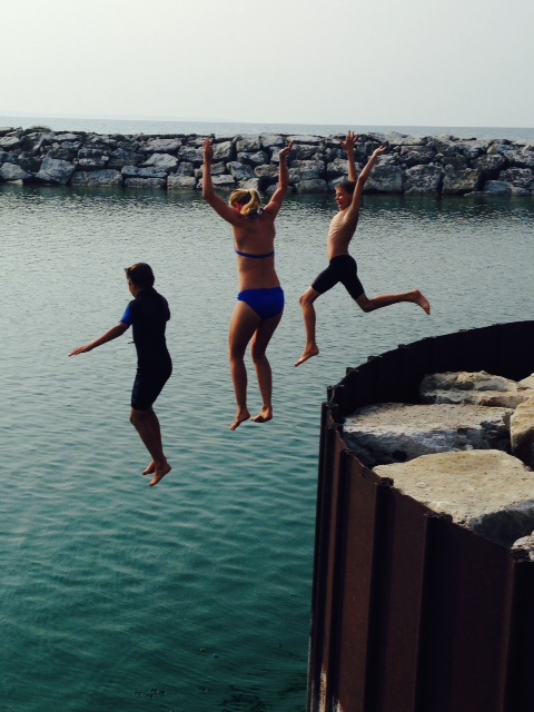
This Mom’s two boys talked her into jumping with them off the end of the jetty into the harbor – YIKES!
On our way to Frankfort on Monday morning, we encountered our second “unplanned gem”. The shoreline is lined with enormous dunes, many of which are 45 stories high!

A dune we passed along the way –

Another dune we passed along the way –
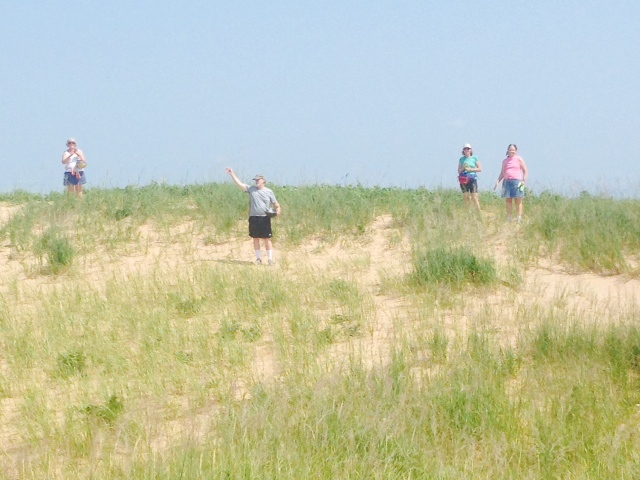
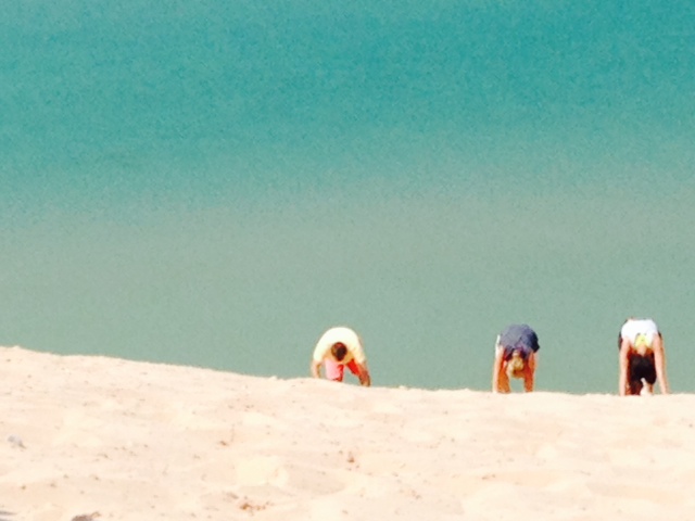
After passing these incredible dunes for awhile, we couldn’t resist – we stopped the boat a few hundred feet offshore at what turned out to be a part of Sleeping Bear Dunes National Lakeshore – we later found out that, in 2011, Good Morning America named Sleeping Dunes National Lakeshore as “the most beautiful place in America”. We launched the dinghy, and I stayed with the boat while Trish, Wendy, and Nif took the dinghy to the beach. The dune where they landed is 45 stories tall, and has a path devoid of vegetation with an observation deck at the top. A number of people were on the dune, climbing up or down. It’s impossible to see the steepness of the slope in the pictures, but climbing was mostly done on all fours. Here are some pictures:

People climbing up and down the dune

Wendy & Nif starting their climb…
Continuing the climb….
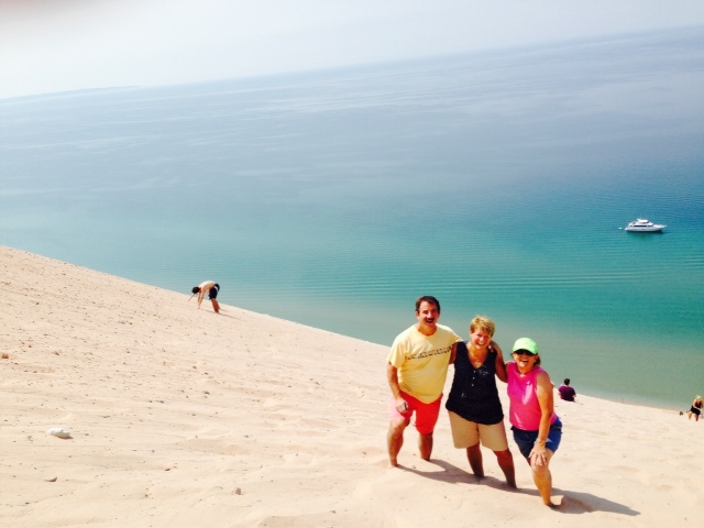
Wendy, Nif, & Trish getting near the top after an hour of climbing…

Others still making the climb. Notice the two boats in the water below to get an idea of the height of this dune – the larger boat is a 100 foot yacht that came by after we stopped. The Joint Adventure is the small speck to the left of the yacht

A sign at the top of the dune near the observation platform. Obviously, many people ignored the advice on the sign –
After several hours, we proceeded to Frankfort, arriving around 5:00 or so. Like most harbors on this part of Lake Michigan, it has a long jetty marked with a tall lighthouse on the end of the jetty:

Wendy, Trish, and Knif on the jetty that goes out to the lighthouse
Frankfort is a pleasant town with a great harbor, numerous shops, and several restaurants overlooking the harbor, but it doesn’t quite have the charm of Leland.
The weather was predicted to deteriorate on Monday with thunderstorms likely in the afternoon, so we left early Monday morning for the 50 mile run to Ludington, where we expect to spend two nights due to nasty weather predicted for Tuesday. Like Leland and Frankfort, Ludington has a long breakwater with a lighthouse at the end – here is a picture of the jetty from the top of the lighthouse, which is open to the public:
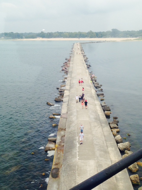
A view from the top of the Ludington lighthouse of the 1/2 mile long jetty leading to the lighthouse
Ludington is a good-sized town with some interesting attractions. A main attraction is the car ferry called the Badger, named after the Wisconsin University Badgers. She is 410′ long, and is the largest car ferry ever to ply the waters of Lake Michigan. Built in 1953 to ferry railroad cars across the lake from Ludington to Manitowac, WI., today she carries cars, trucks, and passengers along the same route. She is still powered by coal-fired steam engines – the only one of her kind remaining. Coal, of course, is not an environmentally-friendly fuel, and there have been ongoing legal and bureaucratic battles over her continued operation – at times, environmentalists and preservationists, normally allies, are battling each other over the Badger. Of more concern than her smoke, the Badger apparently must dump significant quantities of coal ash that contain mercury into the lake each day. She is operating this year via a consent order while negotiations are underway to find a way to keep her operating beyond this fall. In any case, she is a sight to behold coming into Ludington Harbor, where she draws a crowd each evening upon her return from Wisconsin. An old ship that lacks modern maneuvering devices such as bow and stern thrusters, she employs a unique method to turn 180 degrees in the harbor to back in next to her dock – she drops her starboard-side anchor as she approaches he dock, then powers against it spin the boat around. The operation takes about a half hour to get her secured. A sight to behold for a 410′ ship! Here is a picture of the Badger spinning on her anchor in the harbor:

The 410′ coal/steam powered Badger entering Ludington Harbor and spinning around her starboard-side anchor to back into her dock
Ludington also has an extraordinary sculpture park along the harbor. Here are pictures of some of the sculptures:
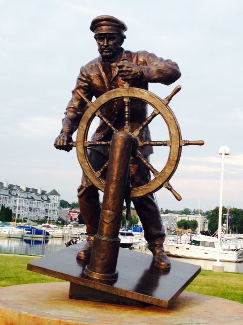
A sculpture dedicated to the fishing heritage of Ludington
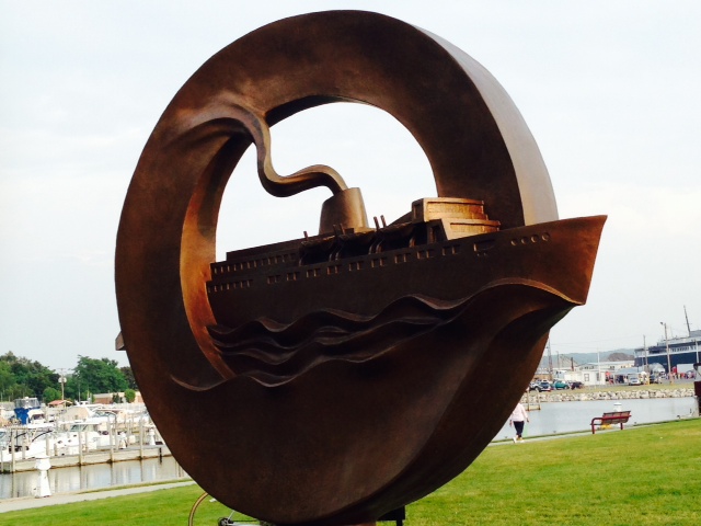
Car ferries (all of which started as ferries to carry railroad cars across the lake) were a major part of Ludington’s economy, replacing the lumber industry as the main economic engine after the nearby lumber resources were depleted. At its height, eight large car ferries carried railroad cars between Ludington and Wisconsin

This sculpture is dedicated to the children, with a plaque noting that the children are the future of Ludington

This one has a plaque commemorating some very successful Ludington minor league baseball teams in recent years
In talking with some local sportfishermen that had just come in, Wendy managed to score some fresh lake trout – they explained to Wendy that it is against the law for sportfishermen to sell fish, but they could give it away – and so they did! After a great dinner of fresh fish on the boat, we had “Movie Night on the Joint Adventure:
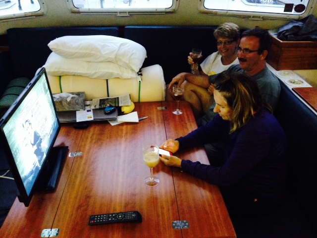
Movie nigt on the Joint Adventure – complete with Amaretto on the rocks…
After 12 glorious days of warm, sunny, perfectly calm days, the weather finally turned and we’re sitting out our first weather day in nearly three weeks. An all day soaking rain combined with winds gusting to 30 MPH have us using the day to catch up on chores, hang out, and generally relax. If the weather allows, tomorrow we hope to run to White Lake.
