Post #29: THE BIG MUDDY – Day 135 , September 15, 2014: On board: Paul, Tom, Hank (my Dad), Jim K
Wow! What a river! The Illinois River was awe-inspiring, but it did not prepare us for this monster of a river – at least not for the Mississippi when she is flexing her muscles. As you undoubtedly have seen on the news, the Midwest has been pounded with enormous rainfalls. Kansas City reportedly received 9″ of rain in a short period of time, and many other areas have had similar monsoons. We experienced two massive, lengthy thunderstorms ourselves. As a result, the Mississippi is today (Monday) cresting at a height of 26.5, just 3 1/2 feet shy of flood stage – it’s normal height is about 11 feet. The consequences are threefold: (1) the current is very fast – now running about 5-6 knots with a lot of turbulence, particularly in places where the river curves sharply (2) anchorages are unusually deep, requiring much more anchor line to be deployed and therefore requiring much more area to swing, and (3) most significantly, huge amounts of debris are being washed down the river – from small branches to entire trees, and including, so far, a stop sign and a huge truck tire & wheel. The debris is so thick at times that avoiding it is like driving a bumper car. The river also fully deserves its nickname The Big Muddy – the water is thick and brown, with zero visibility. Some pictures of the angry river:
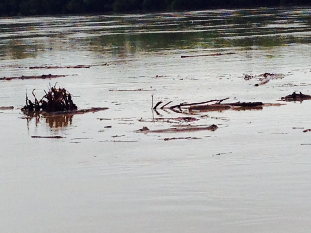
Debris flowing down the Big Muddy after being washed into the rising waters

More debris in the river; pictures can’t capture the enormous amount of debris flowing down the river, nor the enormous size of some of the trees and logs –

Debris that has collected in the lock near St. Louis – we toured the Mississippi River Museum at the lock while in Alton and took this picture from the top of the lock
The Mississippi is the third largest watershed in the world, behind only the Nile in Africa and the Yangtze in Asia. Forty percent of the land area of the U.S is drained through the Mississippi watershed. Because of its length and its reach, taming it to provide a navigable waterway and to control flooding has been a constant work in process for over two centuries. As a result, 77 million tons of goods valued at over $17 billion are shipped on the waterway each year. When shipping by truck, one gallon of fuel can move 1 ton of freight 59 miles; shipping by Mississippi barge, that same ton using that same gallon of fuel will move 514 miles.
However, the river is very different today than it was 200 years ago as a result of the Corp of Engineer’s attempts to tame it. And like most major projects, many of the efforts were controversial and involved significant politicking, and many caused unintended results. In particular, the Corp’s flood control efforts have, at times, increased flooding – dikes were built to protect adjacent lands. The dikes confined the river within a narrow area, preventing it from spreading out. That caused the river to rise even higher, causing more damage when it overtopped the dike. So the dikes were built higher, which confined the river even more. And so on.
Here is a picture of the dike near St. Louis:
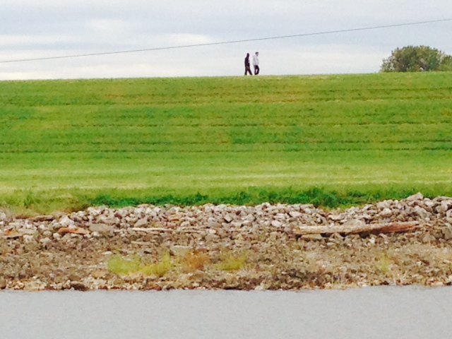
In order to control flooding, the Army Corp of Engineers has constructed massive dikes along both banks of the Mississippi. The people walking on top of the dike provide some scale as to the height of the dikes. One negative aspect of the dikes is that they completely cut off the river visually from the surrounding landscape, whether you’re on the land looking towards the river or you’re on the river looking towards the land
In recent years, efforts have been focused more on adding flood plain space for the river to spread out rather than trying to contain it.
Although there have been scores of floods along the Big Muddy, two stand out. The Great Flood of 1927 swept across an area roughly equal in size to Massachusetts, Connecticut, New Hampshire, and Vermont combined – imagine that entire area under water! Immense human drama and political debates resulted – in order to save New Orleans, a huge breach in the dike would need to be opened with explosives – wiping out entire villages, thousands of homes, farmlands, etc. Who, if anyone, has the legal authority to order or approve such an action? Who is liable for the resulting damage? Who pays for what? What are the moral issues – saving a city of mostly wealthy people by destroying the homes and livelihood of mostly poorer, rural folks? There is a superb book that not only describes what happened but also the moral and legal debate and the political implications of what was done – “Rising Tide: The Great Mississippi Flood of 1927 and How It Changed America” by John Barry. As explained in the book, the aftermath propelled Herbert Hoover into the White House. It is fascinating and reads like a story – I highly recommend it.
The second flood was the Great Flood of 1993, at which time the Mississippi rose to the highest elevation ever recorded. The flood caused $15 billion in damage, but the Corp claimed that their flood-control measures prevented an additional $17 billion in damage from occurring. Others claimed that the river would not have risen to new record highs if the Corp hadn’t so constrained the river with enormous dikes.
Back to our trip. There appears to be somewhere in the vicinity of 50 – 75 boats on the Inland Rivers doing the Great Loop. Like us, most first learned of the high waters when they first arrived on the Mississippi last week. Progress came to a halt, as everyone was advised not to continue on the river past the confluence of the Missouri River (just north of St. Louis) until the water started to recede. So we stopped in Alton, Illinois from last Wednesday till today (Monday), rented a car, and started to explore. The highlight, of course, was St. Louis and the famous arch. Here are some pictures:
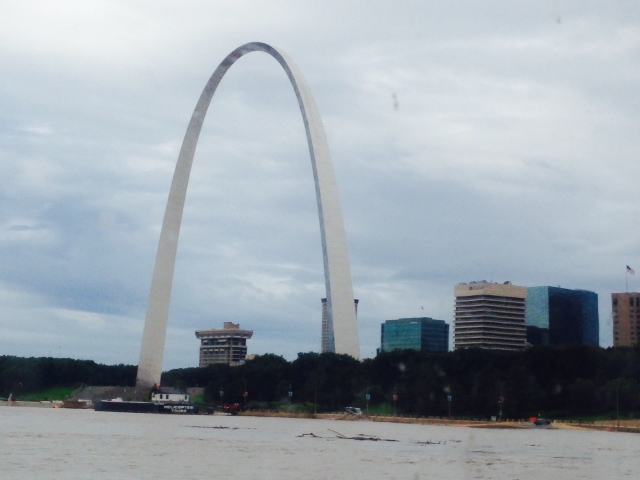
The Gateway Arch, completed in 1965, is 63 stories tall – taller than the John Hancock building in Boston. When you are next to it, the scale is enormous! The museum at the base of the arch is terrific, with a movie about the Louis & Clark expedition, which embarked from St. Louis in 1804, and another about the construction of the arch. Each side was built separately, and leaned inward due to its own weight. In order to join the two sides, they had to use hydraulic jacks to push them apart by four feet!

The gleaming stainless steel skin creates different images from different angles
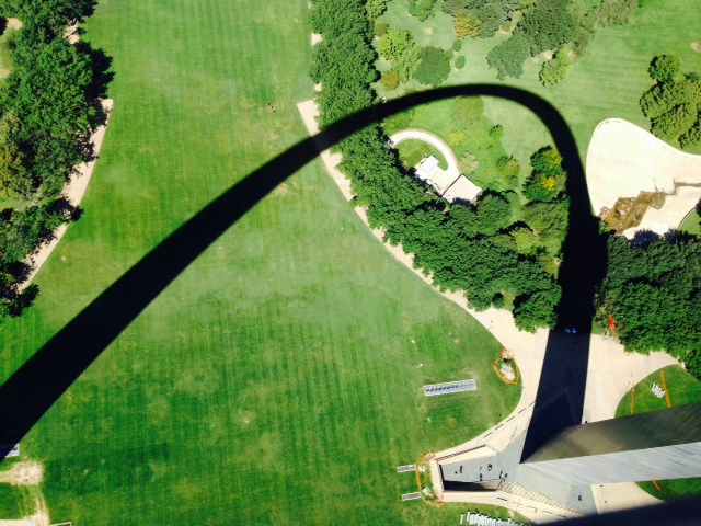
Looking down from the top of the arch, the shadow makes a sculpture of its own on the ground

The Big Muddy as seen from the top of the Gateway Arch, looking south

I couldn’t resist another picture of the river from the top of the arch, looking in north

A capsule which is on a track takes you to the top of the arch – Tom and my Dad are in the capsule, ready for blast-off
While in Alton, we went to a restaurant called “Fast Eddies”. At first, it was not my Dad’s kind of place – loud music, crowds of people, production food. However, before long, he decided maybe we should hang around for awhile after all:

Good to know he’s still got the touch…
Moving south from St. Louis, we’re now entering a stretch of about 250 miles with no marinas and no services – the last marina, about 20 miles south of St. Louis, is called Hoppies, and is run by Hoppie and his wife Fern. It was started in 1934 by Hoppie’s father, and is rustic and basic – it consists of 4 rusting, steel barges chained to the shore. Hoppies provides the last fuel, pump-out, and water for 250 miles, so virtually every boat heading south stops there. More importantly, they are experts regarding the river, its temperament, the best places to anchor going south in different conditions, etc. So every boater going south sits with Fern and gets a lesson on how to navigate the next 250 miles. Since we had time while waiting for the waters to recede a bit, we drove down in our rented car to get our lesson from Fern:

Fern in her ever-present golf cart that she uses to get around as she tends to everyone’s needs at Hoppies

Tom & I getting schooled by Fern about the river going south
The next decision – when do we continue south? There were many factors to consider – When will the river crest? When will the amount of debris in the river diminish? How difficult is the current and the turbulence? With limited room in the limited anchorages for the next 250 miles, how to avoid a huge slug of boats all waiting to resume their voyage south at the same time? Having to anchor for 3-4 nights in a row, what is the weather window during this period? After weighing all these and other factors (and oscillating back and forth several times), we decided to go today (Monday). The downside is that the river is today cresting – thus the current is at its maximum, debris is at or near its maximum, and rain is predicted today. The upside is that heading downriver in subsequent days, the river will be receding, we will be ahead of the crowds at the anchorages, and it appears that a very favorable weather window through Saturday or Sunday is starting tomorrow. So we left this early this morning for Hoppies, arriving by early afternoon. We managed to avoid hitting anything, although entering the first lock was an adventure – the entrance was mostly blocked by debris and there was a strong current swirling at the mouth. As a result, we nearly entered the canal going backwards – not your classic entry. But we got in without damaging our props in the debris, and we made it to Hoppies without a major incident. Here are some pictures:

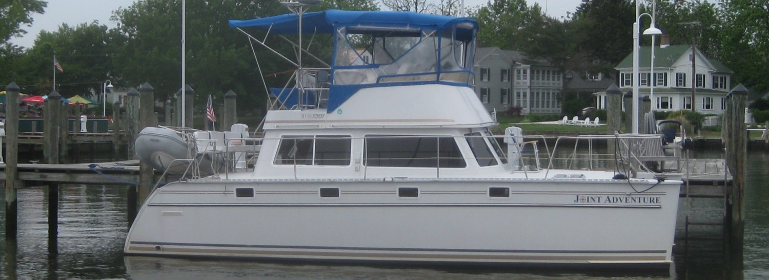
The Joint Adventure tied to the dock (barge) at Hoppies

Debris passing by the barge at Hoppies

Dad and Tom cooking dinner on board – pan-fried fish, rice, and broccoli – what a feast! My turn to cook is next – YIKES!

The house next to Hoppies – another opportunity for Doug to renovate – this one comes with a car to refurbish – note the two extra engines for the car
So tomorrow (Tuesday) we continue south. The next 5 days or so constitute the most challenging part of our trip to date – another 160 miles south on the rain-swollen Mississippi, 60 miles up the Ohio River, then 30 miles up the Cumberland River before we return to civilization. Tuesday night, we will tie to a lock wall where we’re not permitted to leave the boat. The next three nights following that are at anchorages. We came for adventure, and we’re getting it!

Glad you got to visit St. Louis and avoid those river alligators. Did you get to the Blue Owl restaurant down by Hoppies? Deep Dish pies you will not forget! Your photo’s are wonderful and I appreciate seeing and hearing your comments. May you have clear skies and safe passage for the Mississippi leg. By the way, if you are going to Green Turtle Bay, you have to go to Patty’s for their food! Highly recommended. Bob