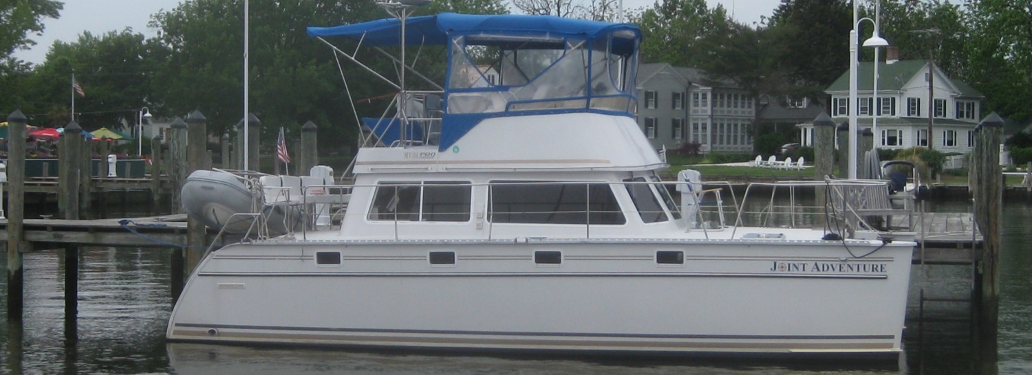
Post #34 – SALTWATER! – Day 167 , October 18, 2014. On board: Paul, Jim K
On Friday afternoon (October 10), as we continued south on the Tenn-Tom Waterway, we crossed the border into our last “western” state – Alabama! The marina is in the town of Pickensville, and 10 miles away is Aliceville. Pickensville is little more than a wide spot in the road, but Aliceville is a sizable town of about 2500 people. Unfortunately, it is a very depressing town which the economy has left behind. More than half the storefronts in the downtown area are boarded up, and many of the houses are in disrepair. Like many towns we have encountered throughout the trip both in Canada and in the US, the development of strip malls, big box stores, and other retail outlets along the highways have starved the downtown areas for business. Aliceville, however, suffers even more from a loss of population and from having few well-paying jobs. This is the soft underbelly of the rural south. Here is a sad picture of Main Street in Aliceville:
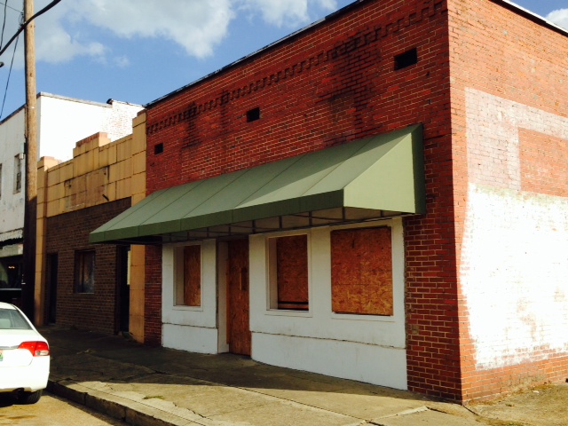
At least half of the storefronts in downtown Aliceville are boarded up and vacant
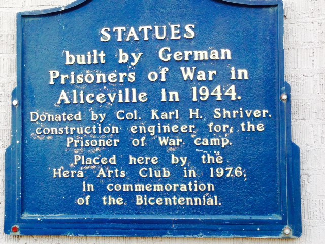
That being said, there are two truly interesting places in Aliceville, which I stumbled upon while out exploring. The first is the Aliceville Museum in downtown Aliceville. During World War II, nearly 400,000 German soldiers were imprisoned in 511 POW camps in the United States. One of the largest of these was in Aliceville, Alabama, which housed over 6,000 prisoners and employed over 1,000 American soldiers and civilians. The camp was built in just 3 months, and in June of 1943, prisoners from General Rommel’s Africa Corp arrived in Aliceville, followed by prisoners from the European theater. The museum tells the story of the camp, and it is an encouraging one: in deep contrast to the treatment which Allied prisoners endured in German and Japanese prison camps, the prisoners at Aliceville were well treated, as evidenced by the many former POW’s who have returned to Aliceville and to the museum, and by the many displays at the museum which were actually donated by former German POW’s. It is a fascinating museum with a film in which several former German POW’s are interviewed.
Pictures were not allowed inside the museum, but here are a couple of images from an area outside the museum where pictures were allowed:
In order to pass the time, prisoners were allowed to put on plays, create paintings, and build statues. Several of the statues created by the prisoners were donated to the museum.
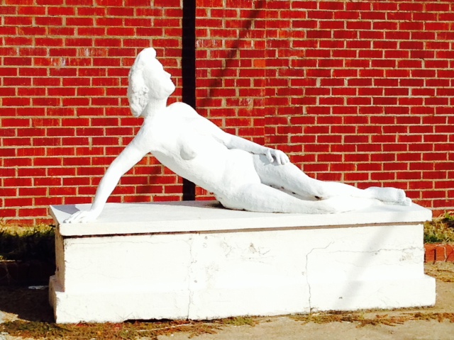
Here is one of the statues donated to the museum – it was just coincidental that I happened to take a picture of the statue of the naked lady –
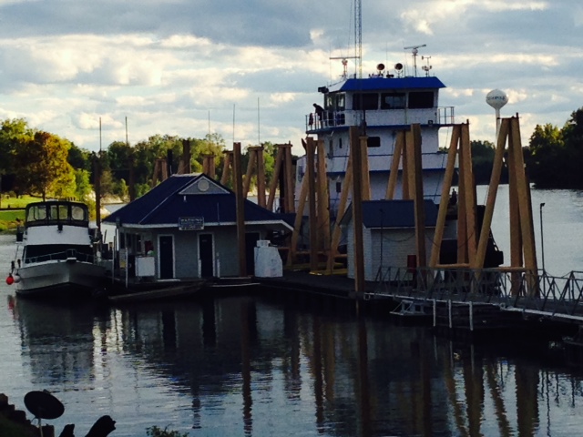
The other interesting place in Aliceville was the US Montgomery, a 178 foot sternwheeler powered by steam that was built in 1925. It was built as a “snagboat” – a specially-designed boat used to hoist from the rivers trees, logs, and other obstructions that impeded navigation- known as “snags”. This steam powered sternwheeler – a relic from earlier times – was actually used to remove snags from the rivers until 1982, when it was finally retired; at the time it was retired, it was the last sternwheeler still in operation in the south, and one of only two steam-powered work boats still in operation in the US. It is now on display and can be boarded in Aliceville, and is on the National Register of Historic Places:

The snagboat US Montgomery – a 178 feet long sternwheeler, powered by steam
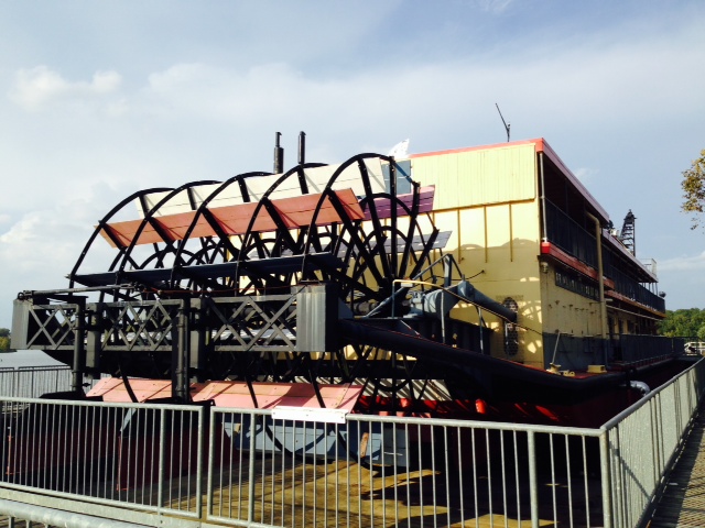
The massive sternwheel, which was the only source of propulsion on the Montgomery. It’s hard to imagine maneuvering this ship in wind and river currents to position it to hoist snags from the river

The massive crane on the front of the Montgomery, used to hoist snags from the river

The very impressive Visitor Center building at the US Montgomery
One sees some unusual sights cruising along the inland rivers. Here are a couple of interesting ones, the first of which is one of the more perplexing:

Suddenly in the middle of nowhere, there was a clearing in the trees along the shore and this appeared – phone call, anyone?

A nice place to swing while you enjoy the view of the water – don’t swing out too far!
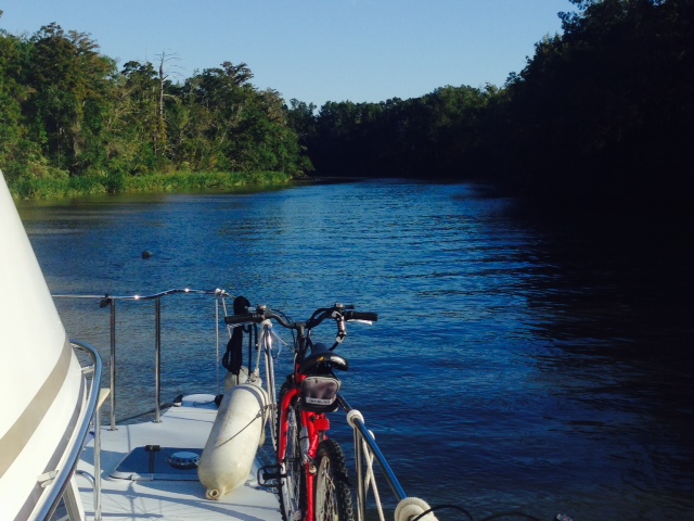
Even though there was a threat of rain and scattered thunderstorms, Saturday night we opted to anchor out rather than run over 90 miles with a lock in the middle. We anchored in a cove immediately next to the waterway – the weather stayed sunny and calm, and the night was clear and windless. Here are some images:
The Joint Adventure at anchor in the cove – the Tenn-Tom Waterway passes by in the background
Part of the Tenn-Tom Waterway was formed by water building up behind dams. In most places, these flooded areas were not cleared of trees and debris prior to flooding. As a result, there are fallen trees, logs, stumps, and other debris lurking below the surface in many locations. Therefore, we always attach a line to the end to the anchor with a float on the other end of the line – called a “trip line” -to help pull it up if it gets snagged on something or if it becomes set hard in the bottom. Paul is shortening the trip line after the anchor was set so we could better identify the location of the anchor as we swung

Out for a joy-ride in the dinghy, exploring the cove
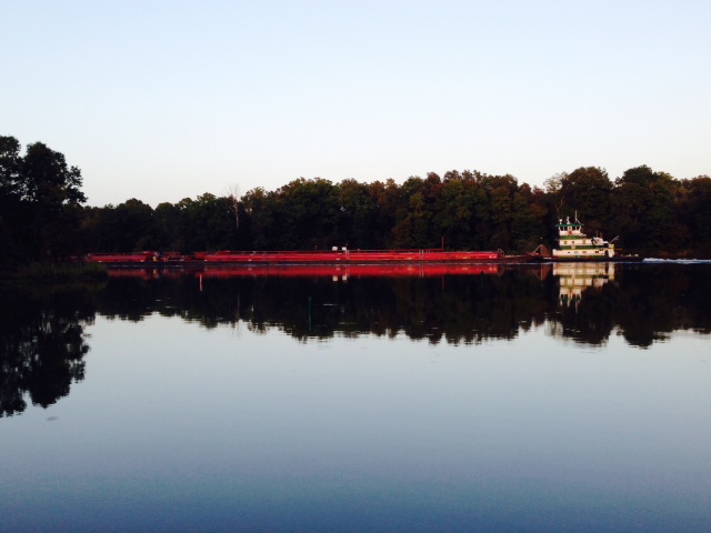
A north-bound tow passing by the cove where we were anchored, just as the sun was setting
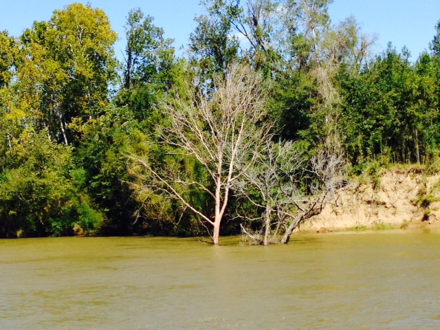
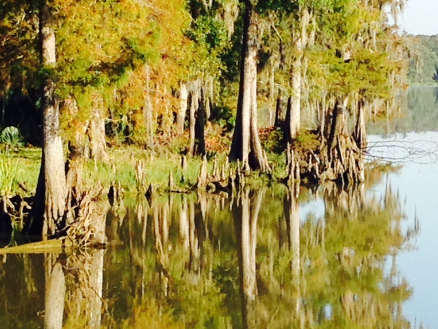
On our last day on the Tenn-Tom, we passed through one of the most beautiful land forms on the inland rivers, called the White Cliffs at Epes. I couldn’t resist taking many pictures, so here are several (I had trouble eliminating pictures…):

The White Cliffs at Epes –


Late Saturday, we entered the last stretch of the inland route to the Gulf, called the Black River-Tombigbee Waterway. A total of 217 miles long, it consists of the lower Tombigbee River below the junction with the Black Warrior River, which then empties into the Mobile River, which takes us to Mobile Bay. The town of Demopolis, Alabama is at the start of this stretch, then it is VERY remote until Mobile Bay – there are no towns and only one “fish camp” with dockage until Mobile. Therefore, we provisioned for 4-5 days and planned to anchor out for at least three nights.
Here are a few images from Demopolis, another town whose downtown has been decimated by strip centers and other retail development along the highway corridor:

I couldn’t figure out what a “Vine & Hoof” shop would be – Paul guessed it would be a wine and beef store. It turned out to be a wine and beer store –

Yes, we’re still in the deep south….

Evidence of the Confederacy abounds – here is a statue honoring the Confederate Dead, located in Confederate Park in Demopolis

Different places that we have visited as we pass through the rural South have dealt with the legacy of slavery in different ways. This historical sign in downtown Demopolis summarizing the history of the city is one example

A gift shop when you visit for some spiritual healing?

This is the fuel dock at Demopolis Marina. Given its strategic location at the start of the Black Warrior- Tombigbee Waterway in an otherwise remote area, the marina serves as a fuel stop to the tug boats that push the barges up and down the river. The tugs rest against the tall yellow steel posts when fueling
Here’s the fuel dock with a tug taking on fuel – they take on as much as 30,000 gallons of diesel fuel! At $3.50/gallon – I ran out of fingers & toes…Notice how the tug dwarfs the building on the dock – the tugs are all engine at the lower level, but the helm must be high enough for the pilot to see over the barges, which stretch out up to 600 feet (two fll football fields, end to end) in front of him!
So as you probably know, a massive storm system passed through the midsection of the country, and especially the south, on Monday and Tuesday, bringing huge rainfalls, near-hurricane force winds, lightning, and tornadoes in some places. Knowing that it was coming, we planned our schedule to be in Demopolis, which ended up to be under a tornado watch for about 12 hours. The storm that hit us was very nasty, but fortunately for us, the worst of the storm passed slightly north of us. However, the high rainfall throughout the watersheds that drain into the Tenn-Tom and Black Warrior-Tombigbee Waterway, caused the water level to rise over 15 feet above normal. The result was swift currents and a resurgence of floating debris, though nothing like we experienced on the Mississippi. Here are a few images:
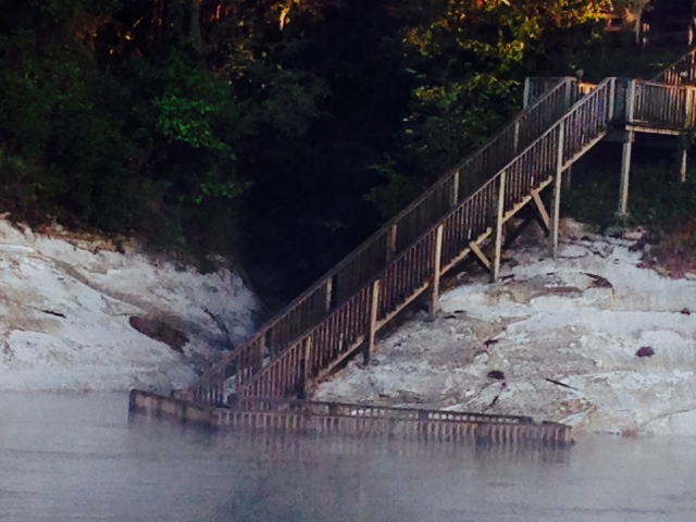
A flooded dock along the Black Warrior-Tombigbee Waterway
High water and swift currents
We stayed in Demopolis for two days due to the storm, then continued south, where we tied up at Bobby’s Fish Camp – it is quite rustic with a single dock parallel to the river, but it served us just fine. Here are a few images:

Bobby’s Fish Camp – notice the Spanish Moss hanging from the trees – we are in the deep south!
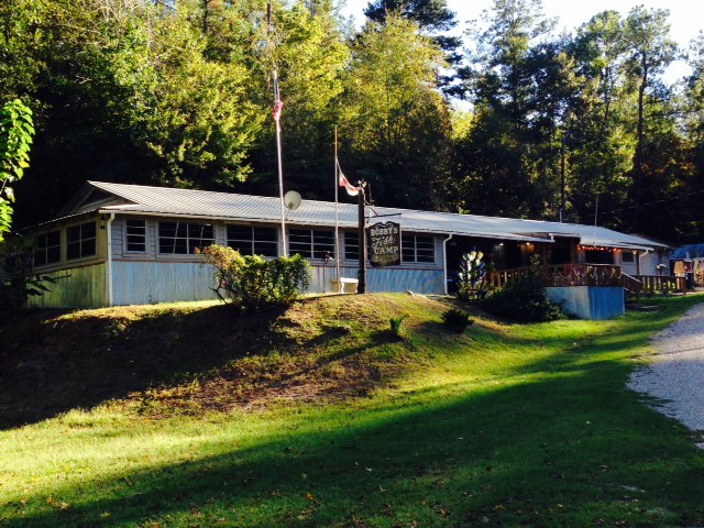
The main building at Bobby’s, which also has a small restaurant that is open just three evenings per week – unfortunately, we were not there on one of them, so we cooked on board
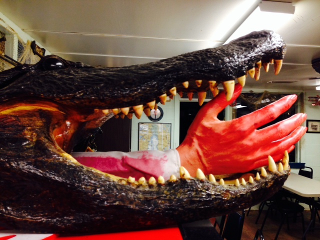
Is this the same guy whose hand got caught in the rear hatch of the minivan? This guy really gets around – he ought to be more careful!
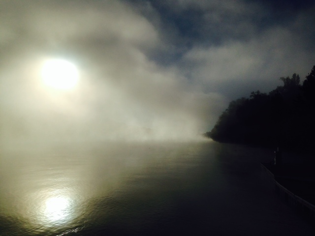
Prior to the storm, the weather has been very hot – mid to high 80’s during the day, mid to high 60’s at night. The water is incredibly warm – like bath water, However, the storm pulled in cold air, so it’s recently been in the 40’s at night – as a result, we’ve had morning fog on the water every day since the storm went through. This is a picture of the fog at Bobby’s as we prepared to cast off.
As we continued, we arrived at our 140th lock since we left Boston – however, this was a very special lock: it is our LAST lock until we reach the lock on the Charles River, back in Boston. Here it is:

I just had to take a picture of it as we exited our last lock – the 140th that we have transited -until we reach the lock at the entrance to the Charles River where we keep the Joint Adventure in Boston
We stayed at two more anchorages on our final push south. Both of these were in fairly narrow creeks, so we needed a stern anchor to keep us from swinging into the banks. However, we couldn’t get the stern anchor to hold (a large aluminum Danforth anchor which proved inadequate), so we ended up with a bow anchor out, then tying the stern to a tree along the shore to hold us in place both nights. Here are some images:

The Joint Adventure at anchor in the narrow creek, with the stern tied to shore

The anchorage in the morning – notice the fog even though the sun has risen quite a bit. The anchorages were very beautiful and quiet
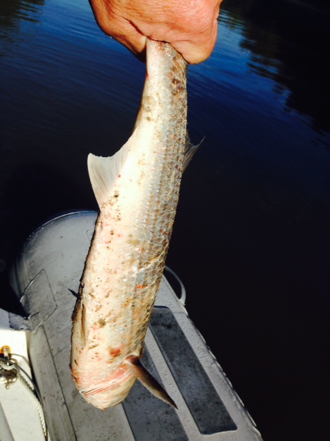
Remember the Asian Carp? We haven’t seen any since the Illinois River. Imagine our surprise in the morning when I got into the dinghy to retrieve our line tied to shore to find this Asian Carp that had jumped into the boat overnight! We say several more jump during our stay at the anchorage.
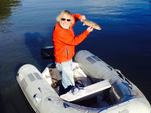
Dinner for two!
The anchorage on our last night before Mobile, in a creek off the Mobile River, about 15 miles north on Mobile

Paul starting to retrieve our stern line, which we tied to an overhanging tree on shore – small fishing boats plied this creek, some at night, so we tied floats onto the line to make sure any boaters saw the line and passed around the other side of us
So for the first time since early May – nearly 5 1/2 months ago – we are again in salt water! We arrived in Mobile Bay this morning – another major milestone on the Great Loop route. We have completed the inland rivers, nearly 1400 miles of waterway that is a unique experience and is the most variable section of the trip. Weather conditions, of course, affect every day on the water. However, on other segments of the trip, a weather system passes and conditions return to normal. On the inland rivers, it can be very different – the effects of a weather system can and sometimes do affect the rivers for weeks. In addition, weather systems from hundreds of miles away that you may not even know about can have a huge effect on you – such was the case when major storms dumped near-record rainfalls on Kansas City and the Upper Missouri River, causing extreme conditions for weeks on the Mississippi – just at the time that most of the Loopers (including us!) were starting to pass through, damaging many of the boats and delaying virtually everyone. The inland rivers also include the most remote and rural sections of the trip, with long stretches (up to 250 miles) with no fuel, water, provisions, or other services, necessitating anchoring for several nights. However, it is also one of the most rewarding sections of the trip, with unique challenges, beautiful scenery, an opportunity to see rural towns and meet wonderful and interesting people in a way that you wouldn’t any other way, and a chance to see and understand the unique role that these vital waterways have played and continue to play in the movement of goods in our economy.
So this morning, we pulled up the anchor and ran the last 15 miles through the city of Mobile and into Mobile Bay. Here are some images:
The last 10 miles or so of the Mobile River run through an enormous cypress swamp

A shanty at the entrance to a creek along the bank of the Mobile River
Our first glimpse of Mobile, coming downriver from the North

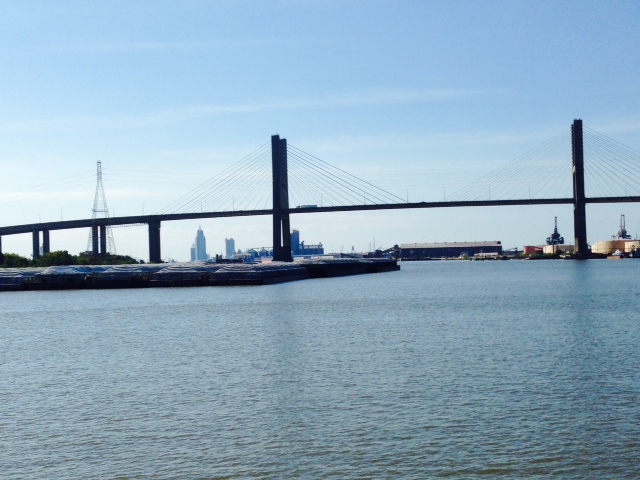
Most of Mobile Harbor is lined with industrial uses on both sides, with a great deal of activity – ships and barges being loaded and unloaded up and down the harbor, dry docks, freighters, barges, tugs, Navy ships – you name it. We saw very few recreational vessels, and they were virtually all small boats out fishing.
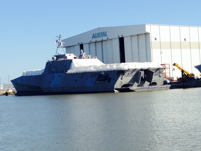
Several Navy “stealth” boats were in the harbor – I’m not sure what they are, but they sure looked intimidating
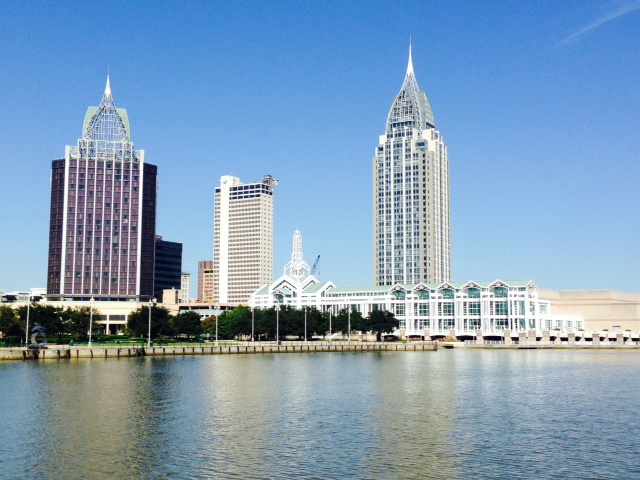
Downtown Mobile from Mobile Harbor – this picture is taken slightly from the south, and shows the one area of the downtown waterfront that isn’t industrial

Some interesting architecture from the water

Entering Mobile Bay – the city of Mobile is in the background.
We’ll be in Mobile for a few days to do some exploring, then we leave the boat here for a week while I go to Buffalo to help celebrate my Dad’s 90th birthday!!!

Great pictures and verbiage..I can’t believe you’ve been gone that long…
Be safe and always enjoy reading your stories
Jimmy Walker
I’m continuing to experience your amazing journey through these great posts.
Thank you,
Bruce — a friend of Tom M.