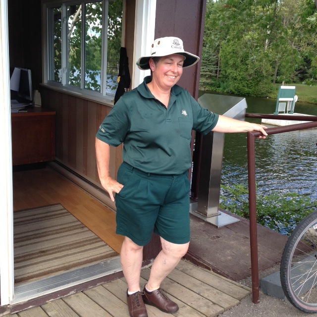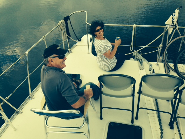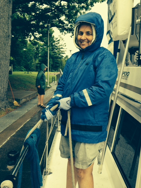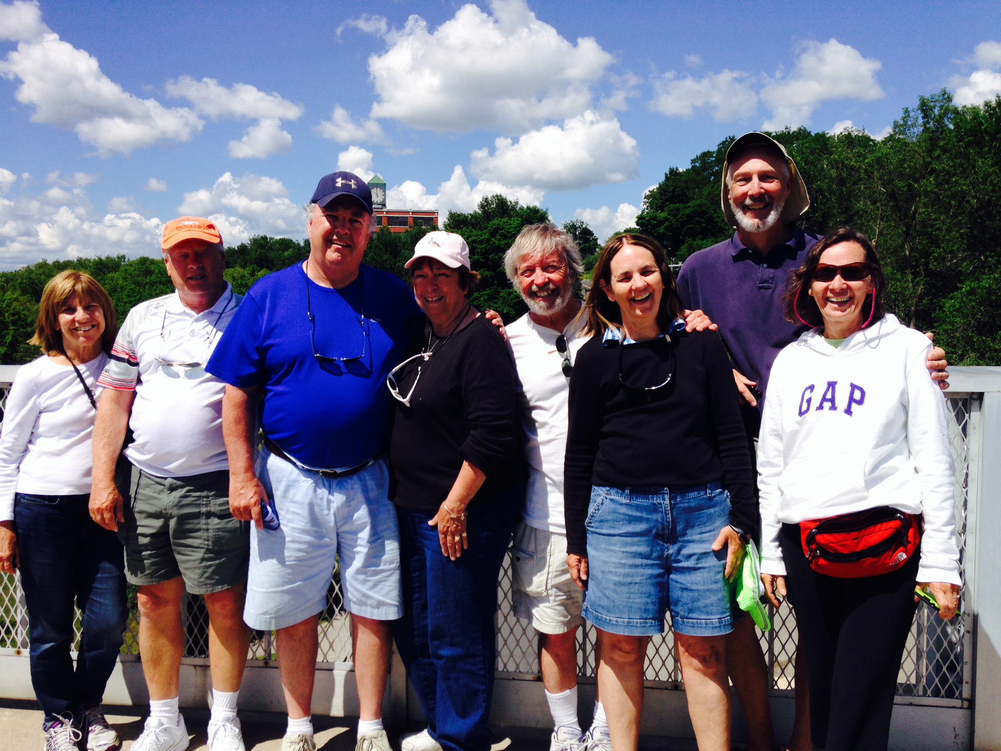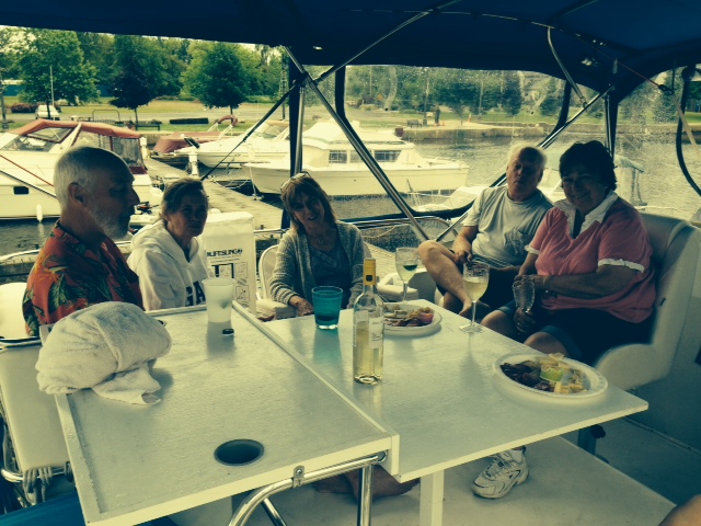
Post #20 – July 26, 2014: On board:Dave & Joan Luciano, Pat & Paul Coates, Jim & Trish Koningisor
Four and a half billion years ago, in the area now known as Georgian Bay, the earth’s crust cracked and enormous amounts of molten rock rushed out of the earth below. It then cooled to form very hard, igneous rock – most of it hard granite, which are some of the oldest rocks in the entire world. Over ensuing eons, shallow lakes flooded the area, and sedimentary rocks were formed, intertwined with some of the ancient granite. The earth’s crust moved time and again, and the rock formations became twisted, folded, and buckled. Then, between 23,00o and 10,000 years ago (a blink of an eye in geologic time), tremendous ice sheets descended upon these rocks from the north – at times, the ice was over one and a half miles thick! As these enormous sheets of ice moved, they gouged out the softer sedimentary rock in places and scoured the hard, granite rock clean. In addition, the tremendous weight of the ice sheets caused the earth’s crust to sag. When the ice finally melted, the result of all of these events is what we now call the Great Lakes, including the unique and spectacular landscape of Georgian Bay.
Georgian Bay, on the north side of Lake Huron, is separated from the rest of the lake by a long peninsula. Due to it’s enormous size, Georgian Bay was once considered to be a 6th Great Lake since it has it’s own currents, wave patterns, and weather systems – it is nearly as big as Lake Ontario. However, it was ultimately designated to be part of Lake Huron, and so it is.
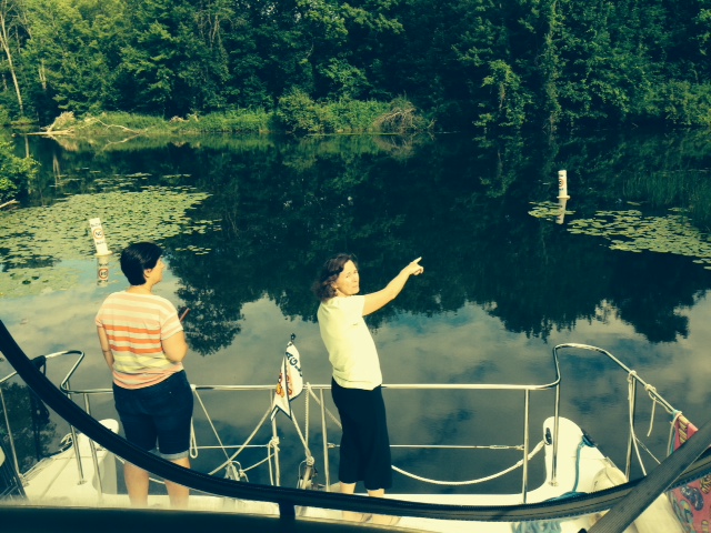
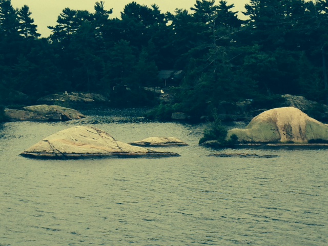
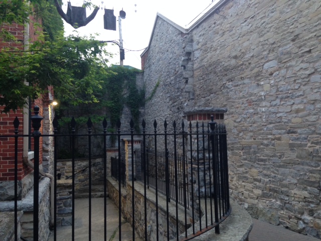
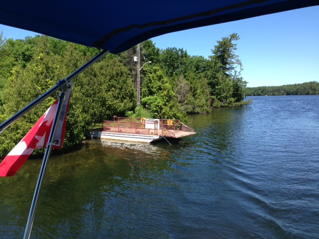
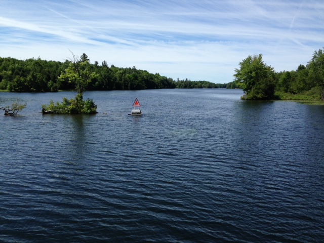
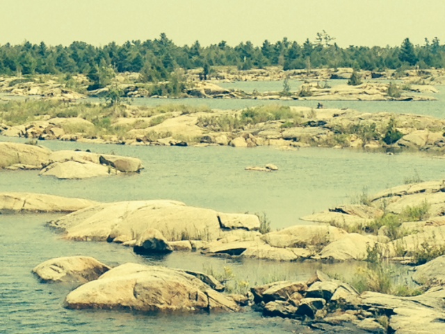
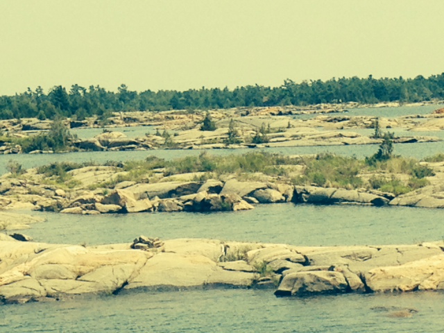
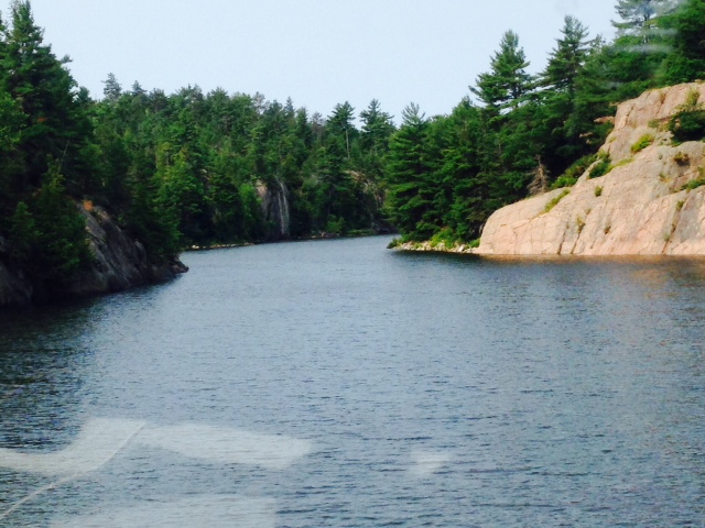
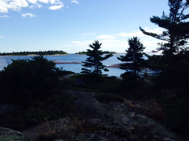
Our trip brought us along the northern edge of Georgian Bay, through what is known as the 30,000 islands. In reality, there are over 100,000 islands if one considers all of the outcroppings of rock to be islands. A navigable route that winds its way among these islands has been charted and marked, and is known as the Small Craft Channel. While the winding channel and narrow, heart-stopping passages make the trip through the Small Craft Channel unforgettable, it is the incredible, one-of-a-kind rock formations that make this area unique in the world. The hard, bald, granite rock surfaces, scoured smooth by the glaciers, protrudes everywhere both above and below the water surface. In places, the channel may be only 20 or 25 feet wide with granite bedrock on both sides, but the depth finder may show 40 or 50 feet of depth below the propellers. In other places, we hold our breath as rocks seem to protrude everywhere as we slowly pick our way through the winding channel. Here are some pictures:
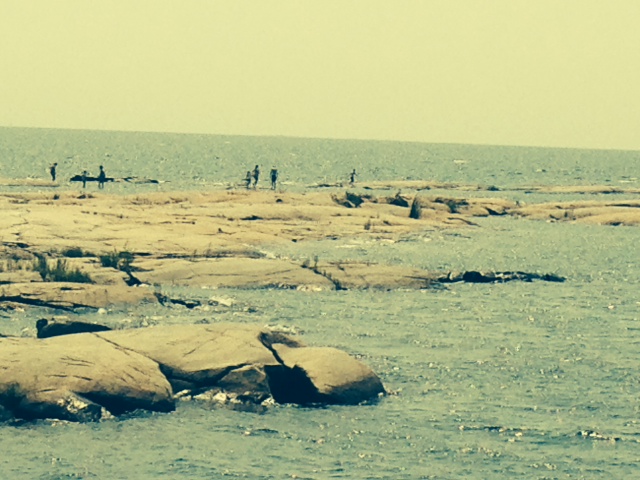
The smooth, almost polished granite rock formations, scoured clean by the glaciers. The people in this picture are from a local kids camp, exploring the rocks and swimming in the pools formed by the rocks – what a playground!

The sea of smooth rocks, both above and below the water, seems to go on forever
More rock formations along the channel
Where is the channel – YIKES!
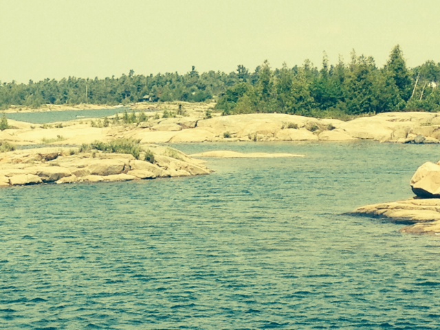
More amazingly beautiful seascape

The channel is well-marked, but we sometimes find ourselves holding our collective breath as we pass through narrows laced with unforgiving rocks

As we approached the end of the Georgian Bay closer to the North Channel (also part of Lake Huron), the rock formations became more vertical and the elevations higher
A narrow channel with 40 feet of depth
OK, enough about rocks.
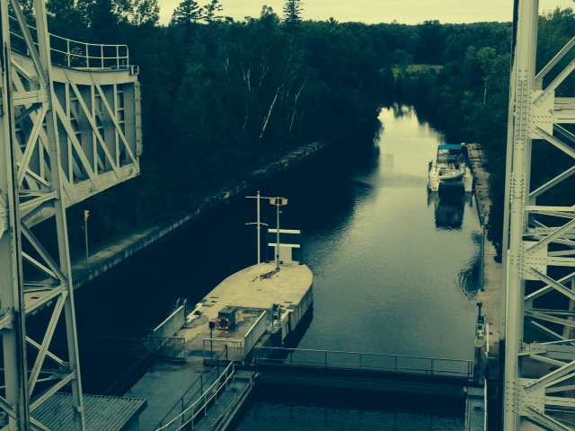
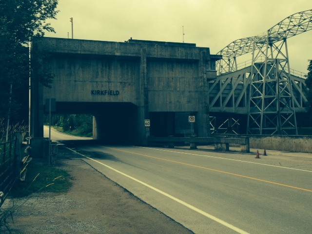
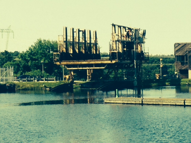
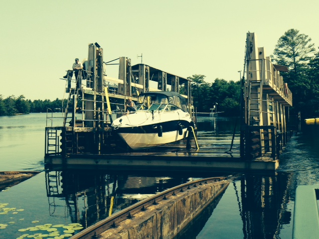
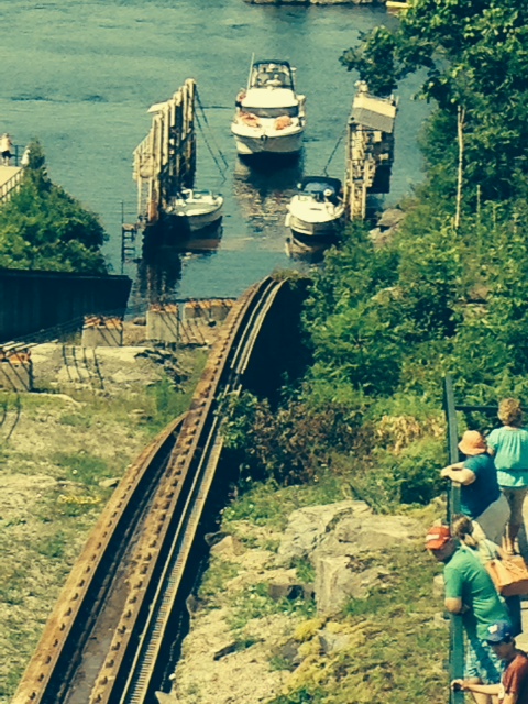
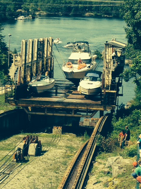
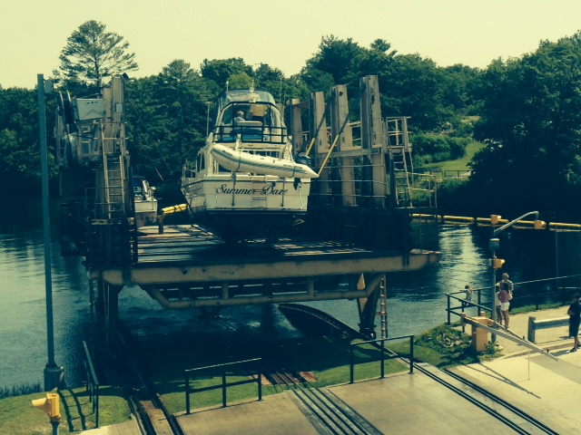
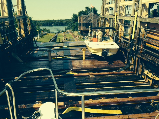
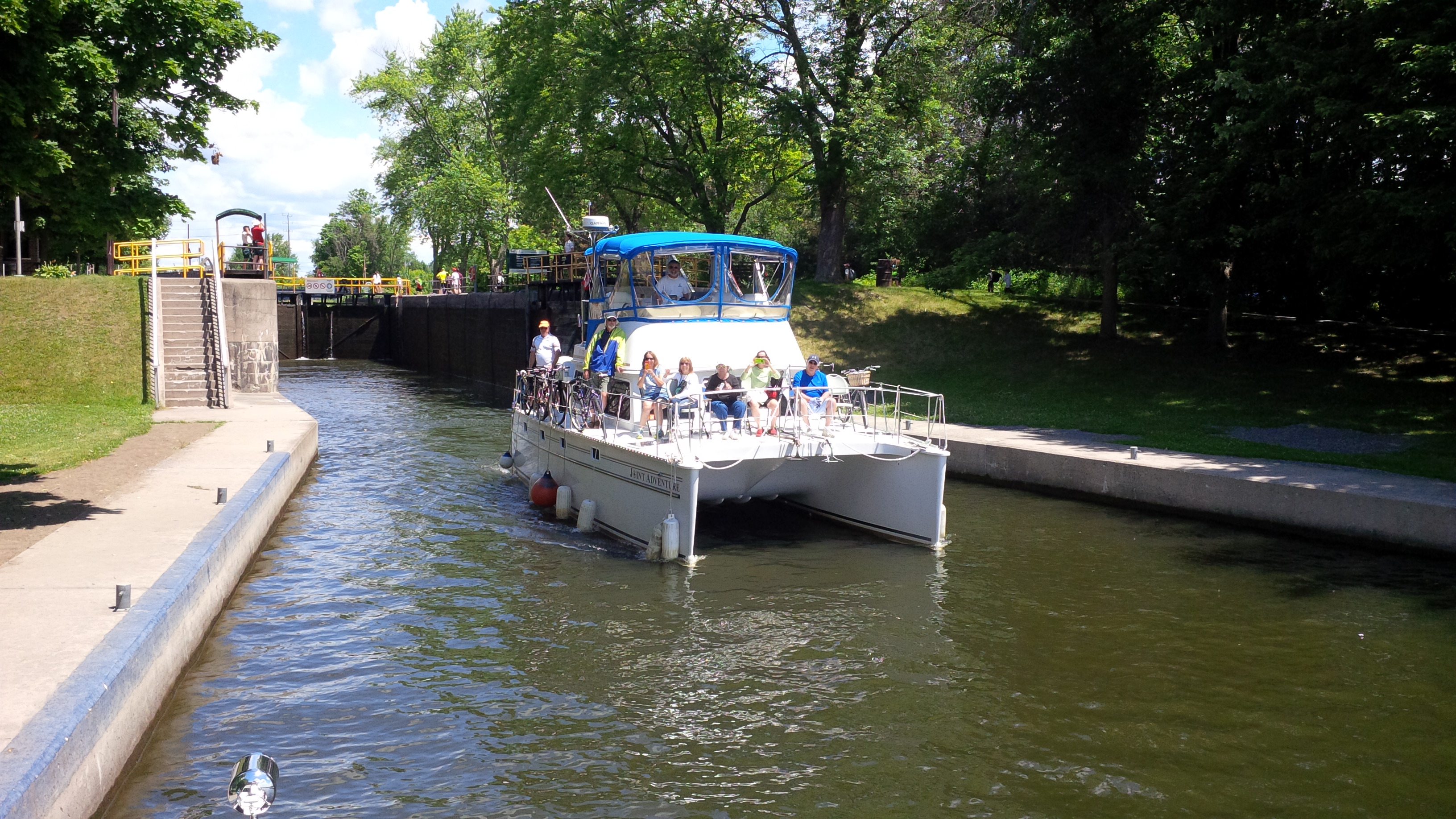
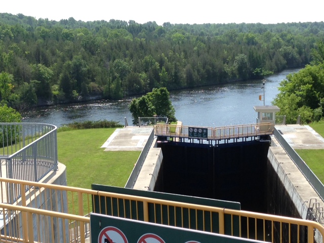
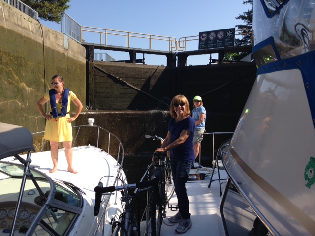
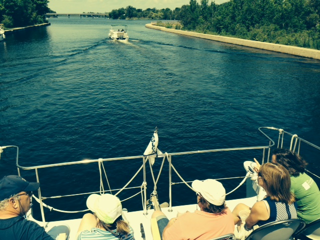
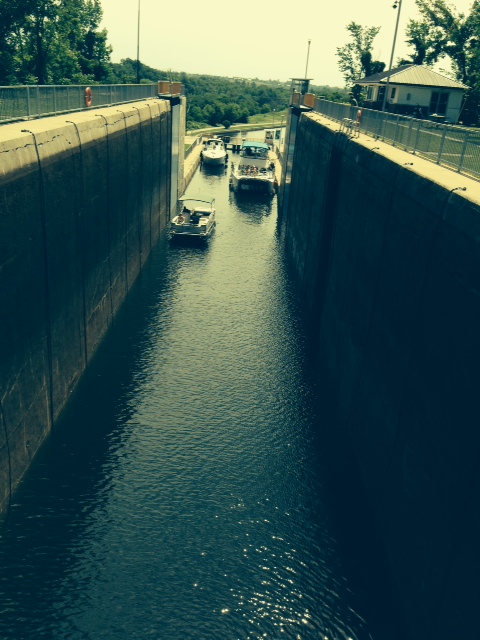
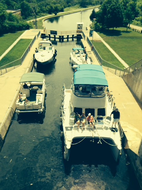
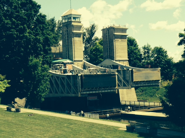
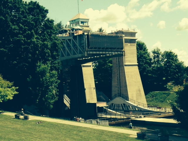
We have now entered a new phase of the trip. Technically, our Great Loop trip started in New York, not Boston – Boston is not on the Great Loop route, but we started there because that is where we live and where the boat was. However, we technically entered the Great Loop route when we arrived in New York. Since that time, in early May, we have been primarily on rivers, canals, and small inland lakes connected by rivers and canals. To get from New York to Georgian Bay, we went through a total of 115 locks, ranging from small locks with an elevation change of a couple of feet in which we barely fit to enormous locks on the St. Lawrence River designed for ocean-going cargo ships to a single lock that raised us 7 stories in one lift to the two amazing lift-locks on the Trent Severn Waterway to the only-one-in-the-world marine railway at Big Chute. We now are in the continuously-connected waters of Lake Huron and then on to Lake Michigan. We have no more locks until we get to Chicago around Labor Day. Weather and especially wind will become even more important as we navigate through much more open waters in this next phase of our voyage.
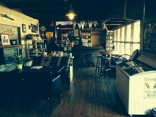
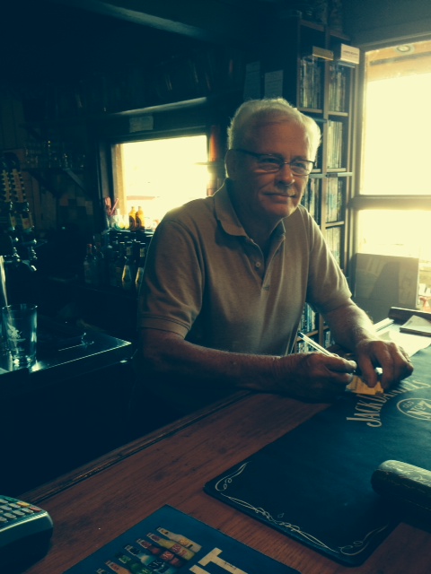
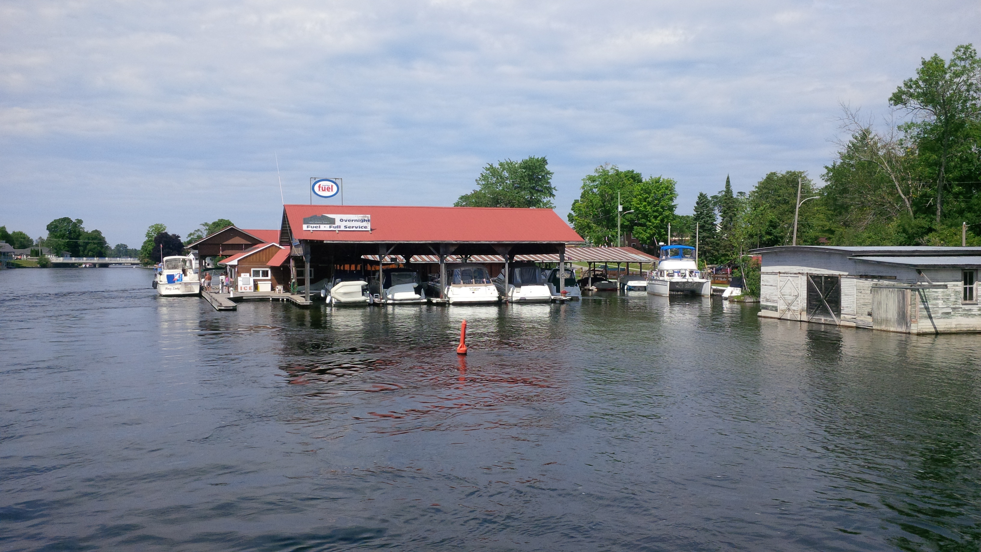
So we left Midland Sunday morning with our new crew and stopped at Henry’s restaurant – another waterfront restaurant on an island accessible only by boat. Henry’s is a bit larger than The Waubic, but just as unusual in its own way. When communicating by radio with Paul, the Owner, regarding docking arrangements, I requested to be at the water-end of a long dock since we often leave before other boats in the morning and I didn’t want to get blocked in (the customer is always right, correct?). “Absolutely negative” bellowed Paul, without apology. What could I say? “Roger that”. Paul had been doing this for 12 years and he know exactly how he wants things done. He turned out to be a great guy and shared a wealth of information with us. Here are a couple pictures of Henry’s:

Henry’s Restaurant as seen from the bridge of the Joint Adventure while docked
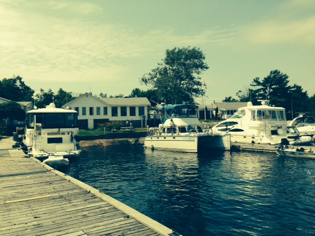
Henry’s with the Joint Adventure at the dock (at the inland end, per Paul)
While at Henry’s that afternoon, a seaplane taxied up to the dock and dropped off three passengers to have a late lunch. Since the plane and its pilot were to sit idle while the passengers had lunch, we made a deal with the pilot to take our three wives for a ride on the seaplane. Here they go!
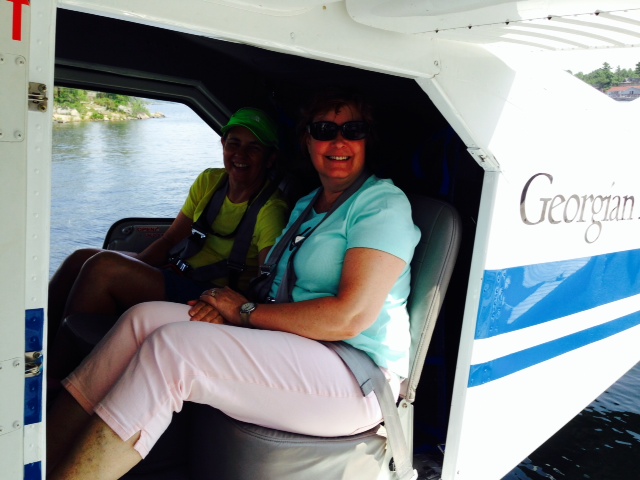
Trish and Joan in the back seat, ready for take-off
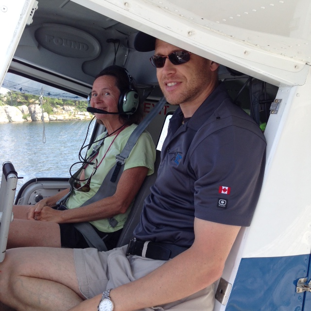
The pilot decided to let Pat fly the plane….

Off they go!
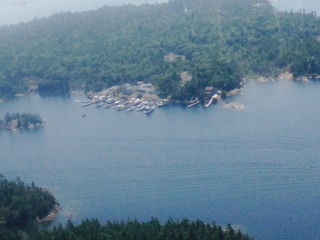
Henry’s Restaurant and associated dockage, from the sea plane
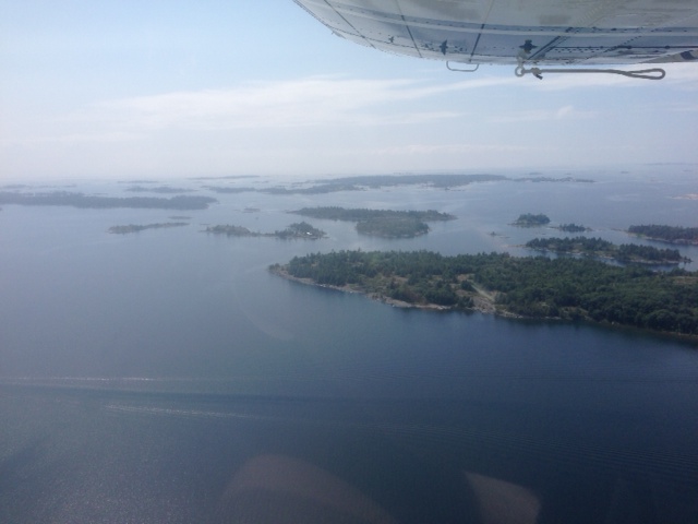
From the air –

Also from the air –

They made it back safely! Pat made a perfect water landing
Henry’s serves fresh fish – pickerel, perch, whitefish, or lake trout, all caught in Georgian Bay or Lake Erie. Paul explained that commercial fishing on the American side was closed in the recent past due to intense lobbying by the sportsmens’ lobby – only sport fishing is allowed. However, commercial fishing is allowed and thriving on the Canadian side, and Paul claimed to be the largest purchaser of fresh water pickerel in the world (I don’t think there are a lot of purchasers outside of Canada).
The day was warm and sunny, so we went for a hike among the rocky landscape and forest:

A stop along the rocky coastline. Left to right, Paul, Pat, Joan, Dave, and Trish. On the way back, the girls stopped at a rock outcropping and went skinny-dipping after sending us back to the boat. Sorry, I couldn’t get any pictures to share
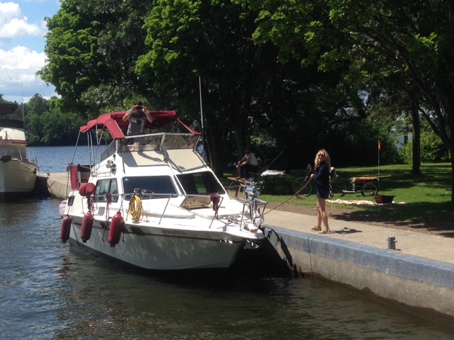
Our next stop was Bayfield Inlet. Everyplace can’t be wonderful. The only thing at Bayfield was the marina, which was, shall we say, less than wonderful. The single, unisex shower was in a run-down shed and was not piped with hot water. Dave found out that the cold water is VERY cold. The marina itself was run down. However, we made the most of a beautiful afternoon with a long and enjoyable bike ride to get ice cream at Point Au Baril, marred only by the horse flies that we couldn’t outrun, even on our bikes. Upon our return, we went for a swim while Dave suffered with his cold shower.
On to Byng Inlet. The wind kicked up and we got knocked around a bit as we navigated an amazing, zig-zag route that took us alternately between protected channels with rocks everywhere and the open bay with 3-4 foot waves. Byng Inlet was a treat, more for the people than the town, which was nearly non-existent. The marina was family run, owned by four brothers from a family of 11 (many of whom we met). The brother who was overall in charge was also the chef at the on-site restaurant – “when you grow up in a family of 11, you learn how to cook”, he explained. However, he was a chef, not a cook. The next day was windy and the run to Killarney, our next destination, was 62 miles and included 20 miles of open water on the bay, so we stayed in Byng Inlet on Wednesday and caught up on chores. We went exploring on our bikes during the afternoon. Here are some pictures from Byng Inlet:
A unique way to carry a dinghy – I wonder what happens in a strong headwind?
A unique way of carrying a canoe

We ventured down a dirt road and came upon widespread outcroppings of smoothly scoured rock. The road in this picture is actually exposed bedrock, with the painted arrow pointing the direction in which the road turns
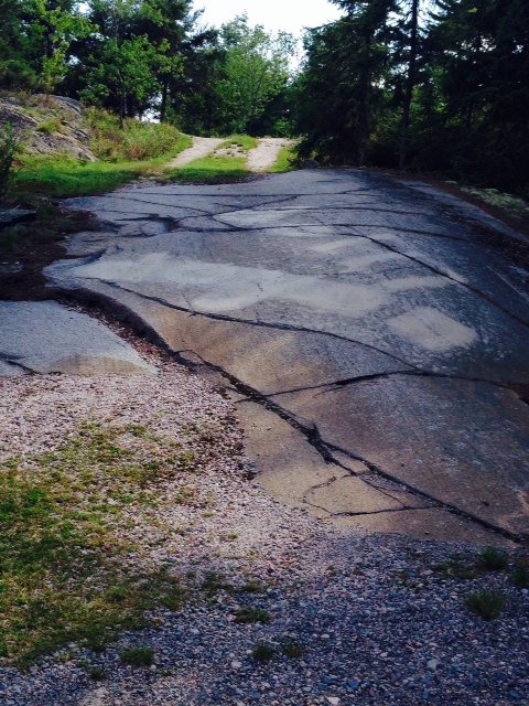
The first 50 feet or so of this driveway is simply exposed bedrock
A view from our bike ride
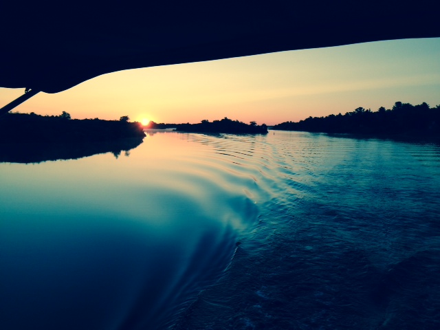
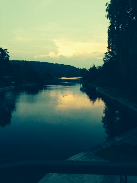
Knowing we had a long open-water passage and with the wind predicted to increase during the day, we left Byng Inlet at first light, casting off before 6:00 AM – this is the sunrise as we headed out the inlet
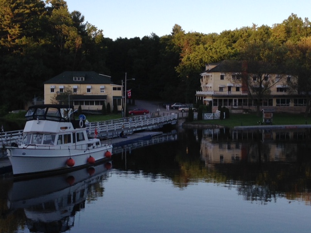
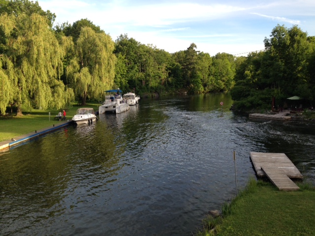
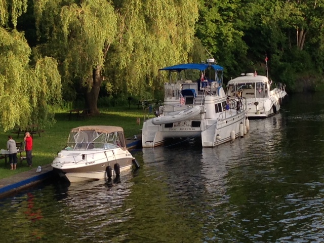
Our 60 mile run to Killarney was uneventful, as the wind behaved and the ride was very pleasant. Killarney is at the crossroads of Georgian Bay and the North Channel, another renowned cruising ground that is a part of Lake Huron. It is a busy little town in July and August, as everyone passing between these two cruising grounds passes through and usually stops for a day or two in Killarney. There are 3 or 4 restaurants in town and 5 marinas along the narrow channel, the largest of which is the Sportsmans Inn where we stayed. A couple of pictures:

The Sportsman’s Inn, taken from across the channel
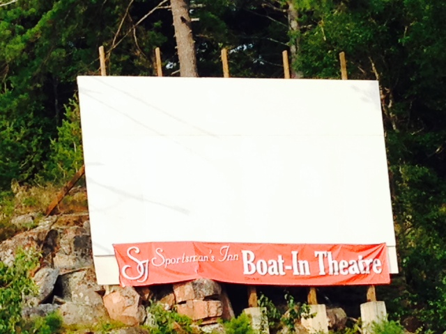
You’ve heard of a drive-in – Killarney has a boat-in. The movie is projected on the screen which faces the docks and you tune into a particular channel on the FM radio and watch the movie from your boat
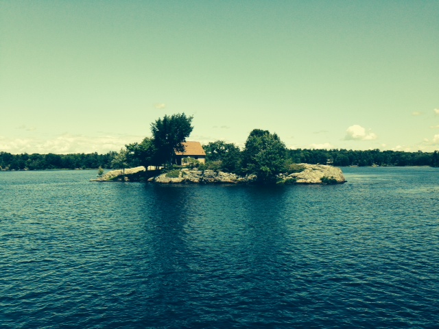
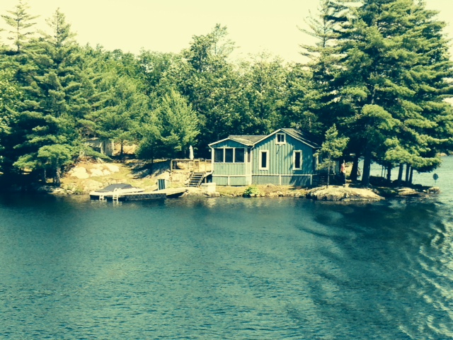
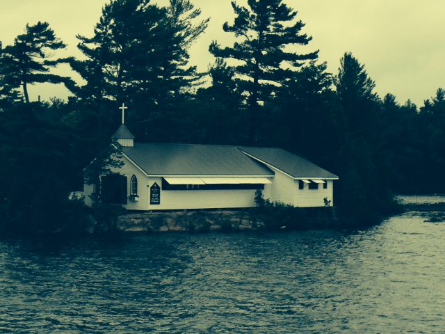
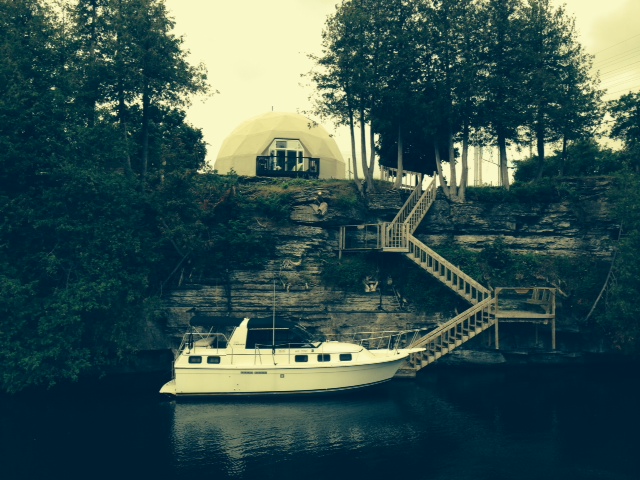
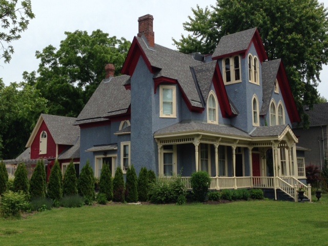
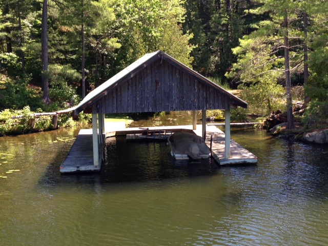
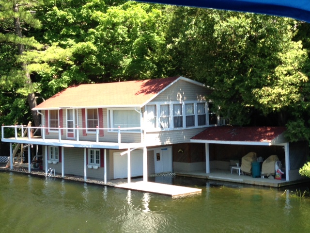
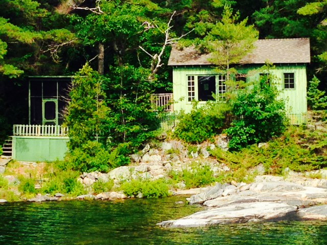
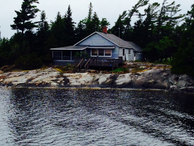
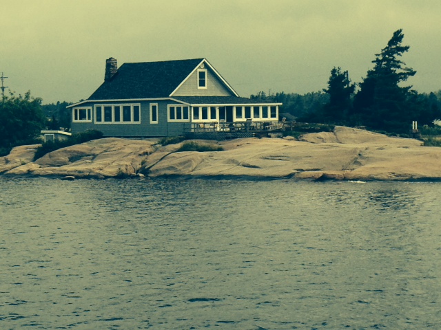
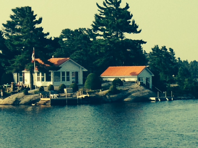
Our trip this week again brought us by hundreds of cottages of all types and sizes built on some of the thousands of islands along the way. Here are pictures of just a few of them:

Just like the many island cottages along the Trent Severn….I could live here….
or here….
or here….
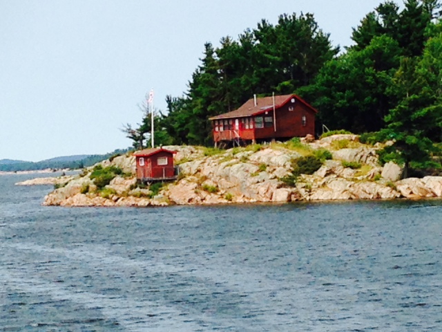
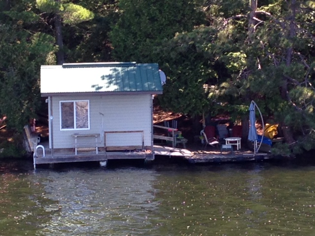
or here (even in the little house at the water’s edge)….
or here…
or here.

This is one of the larger, more elaborate houses that undoubtedly has been built more recently
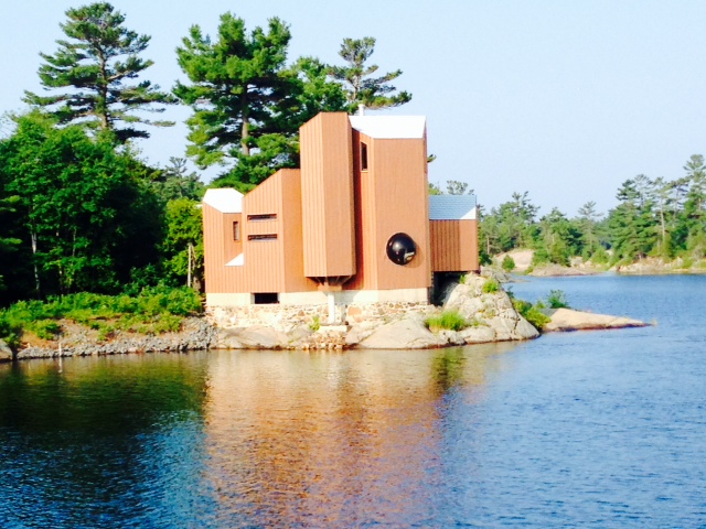
I couldn’t resist taking a picture of this one – the geometric shapes are interesting, but to me, it looks totally out of place – it turns its back on the water, with virtually no windows or deck – in fact, there is a deck on the other side, facing into the island. I could have recommended a good Architect….

Doing everything by water becomes a way of life when you live on an island – islanders come to the market by boat to buy food and supplies
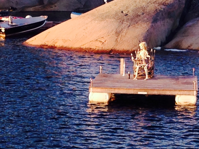
I know you’re out there, fish – I’m going to catch you if it kills me!!
On Friday, we officially entered the North Channel and docked at Little Current, located on Manitoulin Island – which is the largest freshwater island in the world! Little Current is a thriving tourist town during the summer season, with boats coming and going all day long. Sadly, Dave and Joan will leave the boat from here today (Saturday), but happily Jim Small and Chrissie Bell will join us for the next week.
Here are some pictures from Little Current:
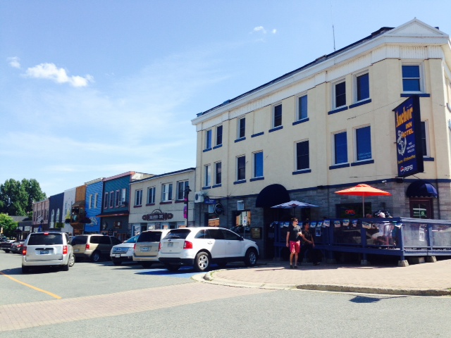
Main Street adjacent to the harbor has several restaurants and numerous shops

Our new friend Tania, whom we met along the way, was unable to get a place to dock at Little Current to stop for lunch, so she rafted up to us for a few hours. Her boat is a really cool 25′ Nordic Tug that is perfectly set up for her

This cruise ship came into Little Current shortly after we docked – this picture is taken from the bridge of the Joint Adventure
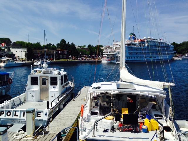
The cruise ship docked at the Little Current waterfront, also taken from the bridge of the Joint Adventure
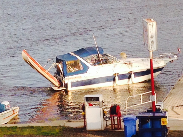
Four young guys on this boat were on the prowl yesterday – I guess this is the best they could do.

My kind of store….

WHAT!!??!? Mom always told me I AM special….

Sure – NOW you tell me…
Tomorrow we cast off to explore and transit the North Channel.